
File:Arctic Sea Route Navigability.png

Size of this preview: 800 × 375 pixels. Other resolutions: 320 × 150 pixels | 978 × 458 pixels.
Original file (978 × 458 pixels, file size: 162 KB, MIME type: image/png)
File history
Click on a date/time to view the file as it appeared at that time.
| Date/Time | Thumbnail | Dimensions | User | Comment | |
|---|---|---|---|---|---|
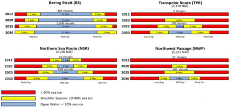
| current | 17:39, 25 May 2018 | | 978 × 458 (162 KB) | Williams.marc (talk | contribs) | DATE-E; Arctic. Arctic Sea Route navigability. US Navy graphic from “U.S. Navy Arctic Roadmap 2014-2030.” Task Force Climate Change. February 2014. Downloaded from http://www.dtic.mil/dtic/tr/fulltext/u2/a595557.pdf |
- You cannot overwrite this file.
File usage
There are no pages that link to this file.