
File:South Torbia terrain map.PNG
Size of this preview: 528 × 600 pixels. Other resolutions: 211 × 240 pixels | 792 × 900 pixels.
Original file (792 × 900 pixels, file size: 781 KB, MIME type: image/png)
File history
Click on a date/time to view the file as it appeared at that time.
| Date/Time | Thumbnail | Dimensions | User | Comment | |
|---|---|---|---|---|---|
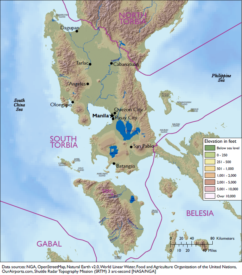
| current | 17:14, 23 April 2018 | | 792 × 900 (781 KB) | Deatrick.laura (talk | contribs) | South Torbia terrain map including elevation, bodies of water, country borders, and major cities. |
- You cannot overwrite this file.
File usage
The following page links to this file: