
Difference between revisions of "Kujenga Infrastructure"
Allen.brian (talk | contribs) (Initial page creation is cut-paste code from Amari Infrastructure) |
|||
| (50 intermediate revisions by 5 users not shown) | |||
| Line 1: | Line 1: | ||
| − | + | <div style="font-size:0.9em; color:#333;" id="mw-breadcrumbs"> | |
| − | <div style="font-size:0.9em; color:#333;">[[Africa|DATE Africa]] > [[ | + | [[Africa|DATE Africa]] > [[Kujenga]] > '''{{PAGENAME}}''' ←You are here |
| − | + | </div> | |
| − | [[ | + | [[File:Kujenga_infrastructure.png|thumb|Kujenga Infrastructure]] |
| + | Kujenga has a relatively low population density and limited infrastructure funding, meaning lower connection rates and more rehabilitation requirements than Amari and Ziwa. Kujenga’s priorities are road paving and natural gas development. | ||
| − | + | Key infrastructure features are the port of Dar Es Salaam and the east-west transit corridor from Dar Es Salaam to Kigoma on Lake Tanganyika, also known as ‘’[[DARGOMA]]’’. This corridor is approximately 70% paved, with a 1930’s era 1,000 mm gauge rail line running throughout. A northern spur runs to the Ziwan capital of Mwanza. The 1970’s-era “DarSouth” 1,035mm-gauge rail line runs from Dar Es Salaam through southern Kujenga. It has one interconnection with the [[DARGOMA]] rail line. | |
| − | + | ||
| − | + | Zanzibar and Mafia islands have more utility connections and more permanent construction patterns than the mainland. | |
| + | |||
| + | Despite abundant natural gas and hydroelectric resources, most Kujengans, especially in rural areas, use wood or charcoal for cooking and oil lamps for lighting. Even those living in urban neighborhoods serviced by electric or water distribution grids are not necessarily connected. | ||
| + | |||
| + | == Major Cities and Urban Zones == | ||
| + | Most Kujengans live along the coastlines of either the Indian Ocean or one of the Great Lakes. The rest of the country is sparsely populated, at 44 residents per km<sup>2</sup>. | ||
| − | + | See Also: [[DATE Africa Regional Infrastructure#Construction Patterns|Regional Construction Patterns]] for a comparative summary. | |
| − | + | {| class="wikitable" | |
| − | + | |+Kujenga Major Cities and Subvariable Descriptions | |
| − | {|class="wikitable" | ||
| − | |+ | ||
!City | !City | ||
!Est Pop (2017) | !Est Pop (2017) | ||
| − | !Pop Dens/ | + | !Pop Dens/km<sup>2</sup> |
!UBD | !UBD | ||
!Rd | !Rd | ||
| Line 23: | Line 27: | ||
!Rail | !Rail | ||
!Sea | !Sea | ||
| − | !Pwr | + | !Pwr. |
| − | !Wtr | + | !Wtr. |
!Sani | !Sani | ||
|- | |- | ||
| − | | | + | |Dar Es Salaam |
| − | | | + | |5,600,000 |
| − | | | + | |4,010 |
|H | |H | ||
| + | |M+ | ||
|M | |M | ||
| − | | | + | |M- |
| − | | | + | |C- |
| − | | | + | |Dv |
| − | | | + | |Dv |
| − | | | + | |Dg |
| − | |||
|- | |- | ||
| − | | | + | |Zanzibar City |
| − | | | + | |718,350 |
| − | | | + | |3,123 |
|H | |H | ||
|M | |M | ||
| − | | | + | |M- |
| − | | | + | |NE |
| − | |M | + | |M- |
| − | | | + | |Dv |
| − | | | + | |Dv |
| − | | | + | |Dv |
|- | |- | ||
| − | | | + | |Dodoma |
| − | | | + | |453,709 |
| − | | | + | |174 |
|H | |H | ||
| − | | | + | |M- |
|M | |M | ||
| − | | | + | |M- |
| − | | | + | |NE |
| − | | | + | |Dv |
| − | | | + | |Dv- |
| − | | | + | |Dv- |
|- | |- | ||
| − | | | + | |Mbeya |
| − | | | + | |437,292 |
| − | | | + | |1,728 |
| + | |H | ||
|M- | |M- | ||
| − | |||
|M | |M | ||
| − | | | + | |M- |
| − | | | + | |NE |
| − | | | + | |Dv |
| − | | | + | |Dv- |
| − | | | + | |Dv- |
|- | |- | ||
| − | | | + | |Kigoma |
| − | | | + | |241,313 |
| − | | | + | |2,603 |
| − | |M | + | |M+ |
| − | | | + | |M- |
| + | |M- | ||
|M- | |M- | ||
| − | | | + | |M-* |
| − | | | + | |Dv |
| − | | | + | |Dv- |
| − | | | + | |Dv- |
| − | |||
|- | |- | ||
|} | |} | ||
| − | <small>''Legend (per TC-7-101): (UBD) | + | <small>''Legend (per TC-7-101): (UBD) urbanized building density, (L) low, (M) medium, (H) high, (P) primitive, (M) moderate, (C) complex, (NE) non-existent, (Dg) degraded, (Dv) developed,''</small> <small>''* lake''</small> |
| − | + | === '''Dar Es Salaam ''' === | |
| + | Dar Es Salaam is the largest city on east Africa’s Indian Ocean seaboard. It serves as Kujenga’s primary trade gateway, with road, rail, air, sea and telecommunications connection quality second only to Amari’s port of Mombasa. The large proportion of vacant or agricultural land within the city limits creates a living environment much more dense than the advertised 4,010/km<sup>2</sup>. Built-up areas accounts for only 18% of land use, focused mainly within a 10 km radius from the center along the coastline and arterial roads. | ||
| − | + | Residential Features | |
| − | + | - Most residential areas are located north, west and south from the City Center. Kinondoni Municipality has the largest residential areas with 110 km<sup>2</sup>, followed by 62 km<sup>2</sup> in Temeke Municipality and 52 km<sup>2</sup> in Ilala Municipality. | |
| − | |||
| − | + | - According to the information from the SUDP, there are two types of residential areas in Dar es Salaam: planned settlements and unplanned settlements. Planned settlements have basic infrastructure and services provided by the local government. They are mainly located in the City Center and its surroundings, such as Mchafukoge, Kivukoni, Kariakoo, Upanga and Ilala in Ilala Municipality; Kinondoni, Oyster Bay, Msasani Peninsular, Mikocheni, Mwananyamala, Kijitonyama, Sinza and Mwenge in Kinondoni Municipality; and Changombe, Temeke, Tandika in Temeke Municipality. Unplanned settlements are mostly poor, with limited accessibility to basic infrastructure and services, such as water, sanitation, electricity and roads. These are scattered all over the city and contain more than 70 percent of the city’s population. | |
| − | + | Commercial Features | |
| − | + | - Light manufacturing industries comprise most of Dar Es Salaam’s industrial base. Most are in the textile, chemical, food processing, beverage, plastic products, cement sectors. Small-scale industries are scattered throughout the city. | |
| − | |||
| − | + | - Most industrial establishments are located in Ilala Municipality and Temeke Municipality, especially along Nyerere Roads. Seaport facilities and its related warehouses are located in Kurasini and Changombe in Temeke Municipality, respectively. | |
| − | + | - The areas between the arterial roads, as well as river valleys, are used for urban agriculture. Most agriculture in Dar Es Salaam is small-scale cultivation of crops such as cassava, sorghum, maize, rice, bananas, legumes, etc. | |
| − | + | - There are still large vacant/agricultural tracts beyond the 10 km radius from the city center. These are decreasing, however, due to recent rapid urbanization and urban sprawl. | |
| + | === ''' Zanzibar City''' === | ||
| + | Zanzibar City is on the east-central side of Zanzibar Island, 25 miles off the coast of mainland Kujenga, less than 50 miles by boat from Dar Es Salaam. Much like Mombasa in neighboring Amari, Zanzibar City retains much original character from its founding Arab traders. Stone Town is a dense, randomly constructed city center, bounded by the waterfront industrial area to the north, the sea to the west, and a residential core periphery to the east. An expansive strip of high income residences and resorts radiates to the southeast, following the coastline along Nyere Rd. Tourism drives the urban economy, while a lucrative clove spice trade dominates the rest of the island and comprises most of the port’s export trade. | ||
| − | + | Zanzibar City boasts the best water and sanitation services in Kujenga. Zanzibar Island as a whole has three times the water service connection rate as mainland Kujenga. The island is dependent on mainland Kujenga for power, via an ageing 132kV, 45MW submarine cable prone to frequent outages. | |
| − | + | === '''Dodoma''' === | |
| + | Dodoma sits at the intersection of the main north-south and east-west road arteries through Kujenga. Its central location made it a key waypoint for both air and the east-west Central railway during the colonial period, however, the DarSouth rail line passes well to the east. | ||
| − | + | Dodoma is sparsely populated and less urbanized that the other large Kujengan cities, with few natural features constraining expansion. Residences are evenly divided between small close orderly block low-rise and organized shantytown settlements. The close orderly block city center is situated between the airport to the north and railway station and “New Dodoma” to the south. A new convention center complex was built next to the rail line in the eastern part of the city. The limited commerce in Dodoma serves mostly the surrounding agricultural companies. | |
| − | + | === '''Mbeya''' === | |
| − | + | Mbeya is largest city in southern Kujenga and is known as the gateway to the southern highlands. The region is also known as the “Scotland of Kujenga” due to its climate and terrain features. It is a key stop on the main north-south Kujengan highway and the Southwest Kujenga Railway. Nearby Songwe Airport has a 10,000 ft. paved runway and features regular service to much of Africa. | |
| − | |||
| − | + | Mbeya is home to a modest light industrial complex and is an important agriculture transshipment point. Southern Kujenga contains the country’s primary coal deposits; a coal-fired power plant is under construction in Mbeya. | |
| − | + | As with other cities in the region’s heartland, Mbeya’s construction pattern is mostly closed block and organized shantytown with a small mid-rise city core. The surrounding commercial areas resemble more strip construction than closed block core periphery. While not as fully developed or sophisticated as Dar Es Salaam, these smaller cities do not have the extreme challenge of massive slums. | |
| − | |||
| − | |||
| + | === ''' Kigoma''' === | ||
| + | Kigoma is the western terminus of the central Kujenga rail line and the DARGOMA transit corridor. Situated on the eastern shore of Lake Tanganyika, it is the major transshipment point for trade with the landlocked central African countries south of Lake Victoria. Consequently, most of these neighboring countries established foreign consulates in Kigoma. | ||
| + | Above the harbor and adjacent to the city center is a closed block hillside residential quarter. Resorts and higher income residences make up the southern portion of the peninsula. A paved ring road surrounds the main part of the city and the Kigoma Airport. Following the typical pattern of east African construction development, a mix of dense random, closed block and shantytown development transitions to less dense agro-urban settlement outside of the ring road. | ||
'''''Image Gallery''''' | '''''Image Gallery''''' | ||
<gallery mode="packed-hover" heights="180"> | <gallery mode="packed-hover" heights="180"> | ||
| − | File: | + | File:DarEsSalaam bus.jpg|City Bus, Dar Es Salaam |
| − | + | File:77906835 x01.jpg| | |
| − | + | File:Train Mbeya.jpg| | |
| − | |||
| − | File: | ||
| − | File: | ||
| − | |||
</gallery> | </gallery> | ||
| + | == Utilities == | ||
| − | ==Electricity Generation and Transmission== | + | === Electricity Generation and Transmission === |
| − | |||
| − | |||
| − | Amari | + | Although Kujenga’s power generation is modest compared to Amari, it has abundant hydroelectric and natural gas sources. Combined, these sources generate almost 80 percent of Kujenga’s electricity. The recent introduction of wind power to the portfolio opens up new possibilities for off-grid and mini-grid power in remote or under-served areas. While about 60% of Dar Es Salaam residents are connected, other urban connection rates are closer to 30%. Kujenga has 18 operational power plants generating 1,400 MW, with another 675 MW of capacity under construction and expected to come on line in the near-term. None of the operating plants have an output greater than 250 MW, and over 60 percent are under 100 MW. For reference, the average American coal-fired power plant generates over 500MW. |
| − | |||
| − | |||
| − | |||
| − | |||
| − | + | Additional natural gas deposits on the Indian Ocean coast present opportunities for Kujenga to increase its generating capacity if an economical transmission system is in place. | |
| − | |||
| − | |||
| − | |||
| − | |||
| − | |||
| − | |||
| − | |||
| − | |||
| − | |||
| − | |||
| − | |||
| − | |||
| − | |||
| − | |||
| − | |||
| − | |||
| − | |||
| − | |||
| − | |||
| − | |||
| − | |||
| − | |||
| − | |||
| − | |||
| − | |||
| − | |||
| − | |||
| − | |||
| − | |||
| − | |||
| − | |||
| − | |||
| − | |||
| − | |||
| − | |||
| − | |||
| − | |||
| − | |||
| − | |||
| − | |||
| − | |||
| − | |||
| − | |||
| − | |||
| − | |||
| − | |||
| − | |||
| − | |||
| − | |||
| − | |||
| − | |||
| − | |||
| − | |||
| − | |||
| − | |||
| − | |||
| − | |||
| − | |||
| − | |||
| − | |||
| − | |||
| − | + | === Water === | |
| − | |||
| − | |||
| − | |||
| − | |||
| − | + | The majority of Kujenga’s terrain drains into Lake Tanganyika, which drains to the Congo River. The rest drains to either the Indian Ocean, or Lake Victoria, which in turn drains to the Nile River. Kujenga is a member of the Nile Watershed Congress, an intergovernmental organization chartered to address access, irrigation, hydroelectric power, and environmental issues related to the Nile. This international agreement restricts upstream irrigation and hydroelectric projects. Downstream members must be approve these projects. | |
| − | |||
| − | + | Over thirty percent of Kujenga’s population has access to piped water – mostly from neighborhood standpipes. In the cities, twice as many residents get their water from neighbor’s taps versus public standpipes. Rural census data is less complete than Amari, however, a comprehensive list of borehole/spring locations corroborates the conclusion that proportionately less of Kujenga’s population is reliant on standing water or vendors. | |
| + | [[File:Africa Infrastructure Schematicv2.png|thumb|Regional Infrastructure]] | ||
| − | + | == Transportation Architecture == | |
| + | === Roads === | ||
| − | + | (Below excerpt from WFP “Logcluster”, https://www.wfp.org/logistics/cluster adapted to Kujengqa from Tanzanian data) | |
| − | |||
| − | |||
| − | |||
| − | |||
| − | |||
| − | |||
| − | |||
| − | |||
| − | |||
| − | |||
| − | |||
| − | |||
| − | |||
| − | |||
| − | |||
| − | |||
| − | |||
| − | |||
| − | |||
| − | |||
| − | |||
| − | |||
| − | |||
| − | |||
| − | |||
| − | |||
| − | |||
| − | |||
| − | |||
| − | |||
| − | |||
| − | |||
| − | |||
| − | |||
| − | |||
| − | |||
| − | |||
| − | + | The Kujenga Road Authority (KRA) maintains both trunk and regional roads. District, urban and feeder roads are the responsibility of the Office for Regional Administration (ORA). Road weight limits are currently 9.000 kg/axle, with a maximum of seven axles or 56,000 kg per vehicle. The most recent overall road condition assessment indicated that 73% were good, 23% were fair and 4% were poor. A slim majority of the trunk roads are paved, with noticeable gaps in the southeast and northwesterly quadrants. The attached map and list describe the current conditions of Kujenga’s trunk and regional road networks. | |
| − | + | Destinations close to tarmac roads are easily accessible even with trucks of over 30 metric tons; otherwise, they cannot be accessed with trucks of over 15 metric tons. Those destinations are thus mostly served by trucks between 10 to 12 metric tons. During rainy seasons, tractors and four-wheel pick-ups are preferable, which in turn adds to the cost of transport. | |
| − | + | There are no bridges or tunnels that impact movement of traffic transported by in-gauge roads. Abnormal and out-of-gauge traffic requires route surveys and permission from Kujenga Road Authorities, Police and other relevant authorities. | |
| − | + | === Rail === | |
| − | |||
| − | |||
| − | |||
| − | |||
| − | + | Kujenga’s rail capacity is second to Amari in the region, measured by track network and rolling stock. It significantly lags behind Amari, however, in track and depot maintenance and rehabilitation. Dual-gauge is a main feature of Kujengan rail: the central corridor line and spurs are meter gauge, while the north-south line is “Cape Gauge” (1,067mm). Like Amari and the other regional countries, the prospect of better access to Africa’s interior markets motivates foreign investment in rail development. In the case of Kujenga, that means an east-west corridor from Kigoma and Mwanza to an upgraded port of Tanga, just north of Dar Es Salaam. The planned rail line is standard gauge, as are all planned rail upgrades throughout the region. | |
| − | + | ||
| − | + | Anticipated cargoes for the east-west routes are containerized freight and bulk agricultural exports. Mineral ores and mining materials account for most of the north-south traffic. Due to maintenance issues driving schedule problems, the rail network only carries approximately five percent of Kujengan freight; most is carried over the steadily-improving road network. | |
| − | |||
| − | |||
| − | |||
| − | |||
| − | |||
| − | |||
| − | |||
| − | |||
| − | |||
| − | |||
| − | |||
| − | |||
| − | |||
| − | |||
| − | |||
| − | |||
| − | |||
| − | |||
| − | |||
| − | |||
| − | |||
| − | |||
| − | |||
| − | |||
| − | |||
| − | |||
| − | |||
| − | |||
| − | |||
| − | |||
| − | |||
| − | |||
| − | |||
| − | |||
| − | |||
| − | |||
| − | |||
| − | |||
| − | |||
| − | |||
| − | |||
| − | |||
| − | |||
| − | |||
| − | |||
| − | |||
| − | |||
| − | |||
| − | |||
| − | |||
| − | |||
| − | |||
| − | |||
| − | |||
| − | |||
| − | |||
| − | |||
| − | |||
| − | |||
| − | |||
| − | |||
| − | |||
| − | |||
| − | |||
| − | |||
| − | |||
| − | |||
| − | |||
| − | |||
| − | |||
| − | |||
| − | |||
| − | |||
| − | |||
| − | |||
| − | |||
| − | |||
| − | |||
| − | |||
| − | |||
| − | |||
| − | |||
| − | |||
| − | |||
| − | |||
| − | |||
| − | |||
| − | |||
| − | |||
| − | |||
| − | |||
| − | |||
| − | |||
| − | |||
| − | |||
| − | |||
| − | |||
| − | |||
| − | |||
| − | |||
| − | |||
| − | |||
| − | |||
| − | |||
| − | |||
| − | |||
| − | |||
| − | |||
| − | |||
| − | |||
| − | |||
| − | |||
| − | |||
| − | |||
| − | |||
| − | |||
| − | |||
| − | |||
| − | |||
| − | |||
| − | |||
| − | |||
| − | |||
| − | |||
| − | |||
| − | |||
| − | |||
| − | |||
| − | |||
| − | |||
| − | |||
| − | |||
| − | |||
| − | |||
| − | |||
| − | |||
| − | |||
| − | |||
| − | |||
| − | |||
| − | |||
| − | |||
| − | |||
| − | |||
| − | |||
| − | |||
| − | |||
| − | |||
| − | |||
| − | |||
| − | |||
| − | |||
| − | |||
| − | |||
| − | |||
| − | |||
| − | |||
| − | |||
| − | |||
| − | |||
| − | |||
| − | |||
| − | |||
| − | |||
| − | |||
| − | |||
| − | |||
| − | |||
| − | |||
| − | |||
| − | |||
| − | |||
| − | |||
| − | |||
| − | |||
| − | |||
| − | |||
| − | |||
| − | |||
| − | |||
| − | |||
| − | |||
| − | |||
| − | |||
| − | |||
| − | |||
| − | |||
| − | |||
| − | |||
| − | |||
| − | |||
| − | |||
| − | |||
| − | |||
| − | |||
| − | |||
| − | |||
| − | |||
| − | |||
| − | |||
| − | |||
| − | |||
| − | |||
| − | |||
| − | |||
| − | |||
| − | |||
| − | |||
| − | |||
| − | |||
| − | |||
| − | |||
| − | |||
| − | |||
| − | |||
| − | |||
| − | |||
| − | |||
| − | |||
| − | |||
| − | |||
| − | |||
| − | |||
| − | |||
| − | |||
| − | |||
| − | |||
| − | |||
| − | |||
| − | |||
| − | |||
| − | |||
| − | |||
| − | |||
| − | |||
| − | |||
| − | |||
| − | |||
| − | |||
| − | |||
| − | |||
| − | |||
| − | |||
| − | |||
| − | |||
| − | |||
| − | |||
| − | |||
| − | |||
| − | |||
| − | |||
| − | |||
| − | |||
| − | |||
| − | |||
| − | |||
| − | |||
| − | |||
| − | |||
| − | |||
| − | |||
| − | |||
| − | |||
| − | |||
| − | |||
| − | |||
| − | |||
| − | |||
| − | |||
| − | |||
| − | |||
| − | |||
| − | |||
| − | |||
| − | |||
| − | |||
| − | |||
| − | |||
| − | |||
| − | |||
| − | |||
| − | |||
| − | |||
| − | |||
| − | |||
| − | |||
| − | |||
| − | |||
| − | |||
| − | |||
| − | |||
| − | |||
| − | |||
| − | |||
| − | |||
| − | |||
| − | |||
| − | |||
| − | |||
| − | |||
| − | |||
| − | |||
| − | |||
| − | |||
| − | |||
| − | |||
| − | |||
| − | |||
| − | |||
| − | |||
| − | |||
| − | |||
| − | |||
| − | |||
| − | |||
| − | |||
| − | |||
| − | |||
| − | |||
| − | |||
| − | |||
| − | |||
| − | |||
| − | |||
| − | |||
| − | |||
| − | |||
| − | |||
| − | |||
| − | |||
| − | |||
| − | |||
| − | |||
| − | |||
| − | |||
| − | |||
| − | |||
| − | |||
| − | |||
| − | |||
| − | |||
| − | |||
| − | |||
| − | |||
| − | |||
| − | |||
| − | |||
| − | |||
| − | |||
| − | |||
| − | |||
| − | |||
| − | |||
| − | |||
| − | |||
| − | |||
| − | |||
| − | |||
| − | |||
| − | |||
| − | |||
| − | |||
| − | |||
| − | |||
| − | |||
| − | |||
| − | |||
| − | |||
| − | |||
| − | |||
| − | |||
| − | |||
| − | |||
| − | |||
| − | |||
| − | |||
| − | |||
| − | |||
| − | |||
| − | |||
| − | |||
| − | |||
| − | |||
| − | |||
| − | |||
| − | |||
| − | |||
| − | |||
| − | |||
| − | |||
| − | |||
| − | |||
| − | |||
| − | |||
| − | |||
| − | |||
| − | |||
| − | |||
| − | |||
| − | |||
| − | |||
| − | |||
| − | |||
| − | |||
| − | |||
| − | |||
| − | |||
| − | |||
| − | |||
| − | |||
| − | |||
| − | |||
| − | |||
| − | |||
| − | |||
| − | |||
| − | |||
| − | |||
| − | |||
| − | |||
| − | |||
| − | |||
| − | |||
| − | |||
| − | |||
| − | |||
| − | |||
| − | |||
| − | |||
| − | |||
| − | |||
| − | |||
| − | |||
| − | |||
| − | + | Major rail yards are located in Dar Es Salaam, Tabora, Kigoma and Mbeya. A transloading terminal in Kidatu services branches on both gauges. | |
| − | |||
| − | |||
| − | |||
| − | |||
| − | + | As with other transit networks, Kujenga’s rail is focused on east-west transit from Indian Ocean ports to the landlocked interior competing with Amari, rather than on north-south cooperation optimal for a trans-African transport system. In particular, a disused 1,000mm gauge rail route from Tanga to Voi, Amari could be a key link in such a north-south corridor. | |
| − | |||
| − | |||
| − | + | === Aviation === | |
| − | + | Dar Es Salaam is the national air hub and the main gateway to the tri-state tourism region in the north. Zanzibar is also a major tourist destination, with regular regional air service to Nairobi, Arusha, and Kampala. The southernmost airport of significance is Mbeya; only two paved airports service southwest Kujenga. | |
| − | + | Kujenga has one state-run regional carrier that operates smaller commuter airliners servicing sub-Saharan capitals and regional airports. Regular passenger service links Dar Es Salaam, Zanzibar, Tanga, Dodoma, Mtwara, Songea, Mbeya, Iringa, Morogoro, Sumbawamba, Kigoma, and Tabora. Numerous charter companies serve these same destinations, with outlying primitive fields used by safari companies and non-governmental service organizations. | |
| − | + | === Maritime Sea ports === | |
| − | + | Kujenga has 6 seaports located along Africa’s east coast. There is only 1 Kujenga port that average more than 1 million tons of cargo throughput annually. There are no Kujenga ports that can accommodate Military Sea Lift (MSC) Commands Large, Medium-Speed Roll-on/Roll-off (LMSR). Kujenga’s Ports Authority (KPA) is a parastatal public corporation acting under the aegis of the Ministry of Infrastructure Development, that has the responsibility "to manage and operate" the ocean ports and lake ports of the country of Kujenga. The Kujenga Ports Authority headquarters are located in Kurasini Dar es Salaam. It is a member of the Port Management Association of Eastern and Southern Africa. | |
| − | + | [[File:Port of Dar es Salaam.png|center|thumb|493x493px|<big>'''Port of Dar es Salaam'''</big>]] | |
| − | + | The Port of Dar es Salaam is the principal port of Kujenga and handles 90% of the countries cargo traffic. The port is divided into two parts (TICTS and TPA), to increase efficiency and encourage new challenges to the local port operators the TPA has authorized TICTS privately owned by Hong Kong investors to receive and clear cargo at the port. The Port also provides a vital transit point for cargo from multiple neighboring landlocked countries. Almost 35 percent of all cargo moving through the port is transit cargo. The port is connected to two railways the Tanzania Central Railway and the TAZARA Railway, however the railways have been depreciating in reliability. The majority of the cargo moves out by road and has been a major bottleneck in expansion plans due to the weak road infrastructure of the city. Major expansion projects have been set in place to increase the capacity and efficiency of the port. After the construction of the Kigamboni Bridge in the city the port plans to create more berths in Kigamboni. Furthermore, the construction of the Bagamoyo mega port has also begun set to help take the load off in 2018. | |
| − | |||
| − | |||
| − | |||
| − | |||
| − | |||
| − | |||
| − | |||
| − | |||
| − | |||
| − | |||
| − | |||
| − | |||
| − | | | ||
| − | |||
| − | |||
| − | |||
| − | |||
| − | |||
| − | |||
| − | |||
| − | |||
| − | |||
| − | |||
| − | |||
| − | |||
| − | |||
| − | |||
| − | |||
| − | |||
| − | |||
| − | |||
| − | |||
| − | |||
| − | |||
| − | |||
| − | |||
| − | |||
| − | |||
| − | |||
| − | |||
| − | |||
| − | |||
| − | |||
| − | |||
| − | |||
| − | |||
| − | |||
| − | |||
| − | |||
| − | |||
| − | |||
| − | |||
| − | |||
| − | |||
| − | |||
| − | |||
| − | |||
| − | |||
| − | |||
| − | |||
| − | |||
| − | |||
| − | |||
| − | |||
| − | |||
| − | |||
| − | |||
| − | |||
| − | |||
| − | |||
| − | |||
| − | |||
| − | |||
| − | |||
| − | |||
| − | |||
| − | |||
| − | |||
| − | |||
| − | |||
| − | |||
| − | |||
| − | |||
| − | |||
| − | |||
| − | |||
| − | |||
| − | |||
| − | | | ||
| − | | | ||
| − | | | ||
| − | |||
| − | |||
| − | |||
| − | |||
| − | |||
| − | |||
| − | |||
| − | |||
| − | |||
| − | |||
| − | |||
| − | |||
| − | |||
| − | |||
| − | |||
| − | |||
| − | |||
| − | |||
| − | |||
| − | |||
| − | |||
| − | |||
| − | |||
| − | |||
| − | |||
| − | |||
| − | |||
| − | |||
| − | |||
| − | |||
| − | |||
| − | |||
| − | |||
| − | |||
| − | |||
| − | |||
| − | |||
| − | |||
| − | |||
| − | |||
| − | |||
| − | |||
| − | |||
| − | |||
| − | |||
| − | |||
| − | |||
| − | |||
| − | |||
| − | |||
| − | |||
| − | |||
| − | |||
| − | |||
| − | |||
| − | |||
| − | |||
| − | |||
| − | |||
| − | |||
| − | |||
| − | |||
| − | |||
| − | |||
| − | |||
| − | |||
| − | |||
| − | |||
| − | |||
| − | |||
| − | |||
| − | |||
| − | |||
| − | |||
| − | |||
| − | + | The Port of Tanga is one of the oldest operating port in the country and was built by the German East Africa Company as the endpoint of the Usambara Railway. The port is the second largest port operating in the country and has an annual capacity of 500,000 tons and is running at 90% capacity. The Ports authority has major plans to upgrade the port increase capacity and provide an alternative route for cargo flowing into the country. The port of Mtwara was built during the British Colonial times. The harbor at the Port of Mtwara was deepened during 1948–1954, and railway line was built connecting the port, as part of the Tanganyika groundnut scheme. The port was functional but underused for many years due to poor transport infrastructure, However, in the years of 2010–2011 when oil and gas exploration activity caused a surge on operations. In December 2015 Alistair Freeport Limited injected $700,000 to construct an export processing zone around the port area. | |
| − | |||
| − | |||
| − | |||
| − | |||
| − | |||
| − | + | . | |
| − | |||
| − | |||
| − | + | . | |
| − | + | . | |
| + | [[File:Kujenga port update 4.png|thumb|1555x1555px]] | ||
| + | . | ||
| − | + | . | |
| − | |||
| − | |||
| − | |||
| − | |||
| − | |||
| − | |||
| − | + | . | |
| − | + | . | |
| − | |||
| − | |||
| − | + | . | |
| − | |||
| − | |||
| − | + | . | |
| − | |||
| − | |||
| − | |||
| − | |||
| − | |||
| − | |||
| − | |||
| − | |||
| − | |||
| − | |||
| − | |||
| − | |||
| − | |||
| − | |||
| − | |||
| − | |||
| − | |||
| − | |||
| − | |||
| − | |||
| − | |||
| − | |||
| − | |||
| − | |||
| − | |||
| − | |||
| − | |||
| − | |||
| − | |||
| − | |||
| − | |||
| − | |||
| − | |||
| − | |||
| − | |||
| − | |||
| − | |||
| − | |||
| − | |||
| − | |||
| − | |||
| − | |||
| − | |||
| − | |||
| − | |||
| − | |||
| − | |||
| − | |||
| − | |||
| − | |||
| − | |||
| − | |||
| − | |||
| − | |||
| − | |||
| − | |||
| − | |||
| − | |||
| − | |||
| − | |||
| − | |||
| − | |||
| − | |||
| − | |||
| − | |||
| − | |||
| − | |||
| − | |||
| − | |||
| − | |||
| − | |||
| − | |||
| − | |||
| − | |||
| − | |||
| − | |||
| − | |||
| − | |||
| − | |||
| − | |||
| − | |||
| − | |||
| − | |||
| − | |||
| − | |||
| − | |||
| − | |||
| − | |||
| − | |||
| − | |||
| − | |||
| − | |||
| − | |||
| − | |||
| − | |||
| − | |||
| − | |||
| − | |||
| − | |||
| − | |||
| − | |||
| − | |||
| − | |||
| − | |||
| − | |||
| − | |||
| − | |||
| − | |||
| − | |||
| − | |||
| − | |||
| − | |||
| − | |||
| + | . | ||
| + | . | ||
| − | + | . | |
| − | |||
| − | |||
| − | |||
| − | |||
| − | |||
| − | |||
| − | |||
| − | |||
| − | === | + | === Petroleum Pipeline and Storage System === |
| − | |||
| − | |||
| − | |||
| − | |||
| − | |||
| − | |||
| − | |||
| − | |||
| − | |||
| − | |||
| − | |||
| − | |||
| − | |||
| − | |||
| − | |||
| − | |||
| − | |||
| − | |||
| − | |||
| − | |||
| − | |||
| − | |||
| − | |||
| − | |||
| − | |||
| − | |||
| − | |||
| − | |||
| − | |||
| − | |||
| − | |||
| − | |||
| − | |||
| − | |||
| − | |||
| − | |||
| − | |||
| − | |||
| − | |||
| − | |||
| − | |||
| − | |||
| − | |||
| − | |||
| − | |||
| − | |||
| − | |||
| − | |||
| − | |||
| − | |||
| − | |||
| − | |||
| − | |||
| − | |||
| − | |||
| − | |||
| − | |||
| − | |||
| − | |||
| − | |||
| − | |||
| − | |||
| − | |||
| − | |||
| − | |||
| − | |||
| − | |||
| − | |||
| − | |||
| − | |||
| − | |||
| − | |||
| − | |||
| − | |||
| − | |||
| − | |||
| − | |||
| − | + | Kujenga’s current petroleum infrastructure was designed to import crude oil to Dar Es Salaam, then transfer inland to southern African countries for refining via a pipeline generally following the Southeast Corridor. A former refinery in Dar Es Salaam now provides the bulk of Kujenga’s storage capacity. All refined petroleum products are imported – mainly from overseas and trucked from Dar Es Salaam. Private interests are competing to build a pipeline from Hoima in Amari, south through Bukoba on the western shore of Lake Victoria. Depending on the progress of an Amari refinery, a crude pipeline could be extended to Tanga, or a product terminal could be developed in western Kujenga to serve the domestic market or further shipment south. | |
| − | + | ||
| − | + | Liquefied Petroleum Gas | |
| − | |||
| − | |||
| − | |||
| − | |||
| − | |||
| − | |||
| − | |||
| − | |||
| − | |||
| − | |||
| − | |||
| − | |||
| − | |||
| − | |||
| − | |||
| − | |||
| − | |||
| − | |||
| − | |||
| − | |||
| − | |||
| − | |||
| − | |||
| − | |||
| − | |||
| − | |||
| − | |||
| − | |||
| − | |||
| − | |||
| − | |||
| − | |||
| − | |||
| − | + | Commercial companies provide licensed liquefied petroleum gas (LPG) storage and handling services. The major coastal terminals are listed in Table 12. Additionally, inland facilities are located in Mbeya, Iringa, Dodoma, Morogoro, Ruvuma, Njombe, Singida, manyara, Geita, Kagera and Kigoma. There is a brisk business in unlicensed LPG distribution and kerosene/diesel smuggling. | |
| − | |||
| − | |||
| − | |||
| − | |||
| − | |||
| − | |||
| − | |||
| − | |||
| − | |||
| − | |||
| − | |||
| − | |||
| − | |||
| − | |||
| − | |||
| − | |||
| − | |||
| − | |||
| − | |||
| − | |||
| − | |||
| − | |||
| − | |||
| − | |||
| − | |||
| − | |||
| − | |||
| − | |||
| − | |||
| − | |||
| − | |||
| − | |||
| − | |||
| − | |||
| − | |||
| − | |||
| − | |||
| − | |||
| − | |||
| − | |||
| − | |||
| − | |||
| − | |||
| − | |||
| − | |||
| − | |||
| − | |||
| − | |||
| − | |||
| − | |||
| − | |||
| − | |||
| − | |||
| − | |||
| − | |||
| − | |||
| − | |||
| − | |||
| − | |||
| − | |||
| − | |||
| − | |||
| − | |||
| − | |||
| − | |||
| − | |||
| − | |||
| − | |||
| − | |||
| − | |||
| − | |||
| − | |||
| − | |||
| − | |||
| − | |||
| − | |||
| − | |||
| − | + | == Pollution == | |
| − | |||
| − | |||
| − | |||
| − | |||
| − | ==Pollution | ||
| − | |||
| + | Kujenga’s main sources of water pollution are human waste, industrial and fertilizer chemical runoff, and mine tailings. The latter is most pronounced at unauthorized mining sites. | ||
| − | |||
[[Category:DATE]] | [[Category:DATE]] | ||
[[Category:Africa]] | [[Category:Africa]] | ||
| − | [[Category: | + | [[Category:Kujenga]] |
| + | <references /> | ||
Latest revision as of 20:31, 2 July 2020

Kujenga has a relatively low population density and limited infrastructure funding, meaning lower connection rates and more rehabilitation requirements than Amari and Ziwa. Kujenga’s priorities are road paving and natural gas development.
Key infrastructure features are the port of Dar Es Salaam and the east-west transit corridor from Dar Es Salaam to Kigoma on Lake Tanganyika, also known as ‘’DARGOMA’’. This corridor is approximately 70% paved, with a 1930’s era 1,000 mm gauge rail line running throughout. A northern spur runs to the Ziwan capital of Mwanza. The 1970’s-era “DarSouth” 1,035mm-gauge rail line runs from Dar Es Salaam through southern Kujenga. It has one interconnection with the DARGOMA rail line.
Zanzibar and Mafia islands have more utility connections and more permanent construction patterns than the mainland.
Despite abundant natural gas and hydroelectric resources, most Kujengans, especially in rural areas, use wood or charcoal for cooking and oil lamps for lighting. Even those living in urban neighborhoods serviced by electric or water distribution grids are not necessarily connected.
Major Cities and Urban Zones
Most Kujengans live along the coastlines of either the Indian Ocean or one of the Great Lakes. The rest of the country is sparsely populated, at 44 residents per km2.
See Also: Regional Construction Patterns for a comparative summary.
| City | Est Pop (2017) | Pop Dens/km2 | UBD | Rd | Air | Rail | Sea | Pwr. | Wtr. | Sani |
|---|---|---|---|---|---|---|---|---|---|---|
| Dar Es Salaam | 5,600,000 | 4,010 | H | M+ | M | M- | C- | Dv | Dv | Dg |
| Zanzibar City | 718,350 | 3,123 | H | M | M- | NE | M- | Dv | Dv | Dv |
| Dodoma | 453,709 | 174 | H | M- | M | M- | NE | Dv | Dv- | Dv- |
| Mbeya | 437,292 | 1,728 | H | M- | M | M- | NE | Dv | Dv- | Dv- |
| Kigoma | 241,313 | 2,603 | M+ | M- | M- | M- | M-* | Dv | Dv- | Dv- |
Legend (per TC-7-101): (UBD) urbanized building density, (L) low, (M) medium, (H) high, (P) primitive, (M) moderate, (C) complex, (NE) non-existent, (Dg) degraded, (Dv) developed, * lake
Dar Es Salaam
Dar Es Salaam is the largest city on east Africa’s Indian Ocean seaboard. It serves as Kujenga’s primary trade gateway, with road, rail, air, sea and telecommunications connection quality second only to Amari’s port of Mombasa. The large proportion of vacant or agricultural land within the city limits creates a living environment much more dense than the advertised 4,010/km2. Built-up areas accounts for only 18% of land use, focused mainly within a 10 km radius from the center along the coastline and arterial roads.
Residential Features
- Most residential areas are located north, west and south from the City Center. Kinondoni Municipality has the largest residential areas with 110 km2, followed by 62 km2 in Temeke Municipality and 52 km2 in Ilala Municipality.
- According to the information from the SUDP, there are two types of residential areas in Dar es Salaam: planned settlements and unplanned settlements. Planned settlements have basic infrastructure and services provided by the local government. They are mainly located in the City Center and its surroundings, such as Mchafukoge, Kivukoni, Kariakoo, Upanga and Ilala in Ilala Municipality; Kinondoni, Oyster Bay, Msasani Peninsular, Mikocheni, Mwananyamala, Kijitonyama, Sinza and Mwenge in Kinondoni Municipality; and Changombe, Temeke, Tandika in Temeke Municipality. Unplanned settlements are mostly poor, with limited accessibility to basic infrastructure and services, such as water, sanitation, electricity and roads. These are scattered all over the city and contain more than 70 percent of the city’s population.
Commercial Features
- Light manufacturing industries comprise most of Dar Es Salaam’s industrial base. Most are in the textile, chemical, food processing, beverage, plastic products, cement sectors. Small-scale industries are scattered throughout the city.
- Most industrial establishments are located in Ilala Municipality and Temeke Municipality, especially along Nyerere Roads. Seaport facilities and its related warehouses are located in Kurasini and Changombe in Temeke Municipality, respectively.
- The areas between the arterial roads, as well as river valleys, are used for urban agriculture. Most agriculture in Dar Es Salaam is small-scale cultivation of crops such as cassava, sorghum, maize, rice, bananas, legumes, etc.
- There are still large vacant/agricultural tracts beyond the 10 km radius from the city center. These are decreasing, however, due to recent rapid urbanization and urban sprawl.
Zanzibar City
Zanzibar City is on the east-central side of Zanzibar Island, 25 miles off the coast of mainland Kujenga, less than 50 miles by boat from Dar Es Salaam. Much like Mombasa in neighboring Amari, Zanzibar City retains much original character from its founding Arab traders. Stone Town is a dense, randomly constructed city center, bounded by the waterfront industrial area to the north, the sea to the west, and a residential core periphery to the east. An expansive strip of high income residences and resorts radiates to the southeast, following the coastline along Nyere Rd. Tourism drives the urban economy, while a lucrative clove spice trade dominates the rest of the island and comprises most of the port’s export trade.
Zanzibar City boasts the best water and sanitation services in Kujenga. Zanzibar Island as a whole has three times the water service connection rate as mainland Kujenga. The island is dependent on mainland Kujenga for power, via an ageing 132kV, 45MW submarine cable prone to frequent outages.
Dodoma
Dodoma sits at the intersection of the main north-south and east-west road arteries through Kujenga. Its central location made it a key waypoint for both air and the east-west Central railway during the colonial period, however, the DarSouth rail line passes well to the east.
Dodoma is sparsely populated and less urbanized that the other large Kujengan cities, with few natural features constraining expansion. Residences are evenly divided between small close orderly block low-rise and organized shantytown settlements. The close orderly block city center is situated between the airport to the north and railway station and “New Dodoma” to the south. A new convention center complex was built next to the rail line in the eastern part of the city. The limited commerce in Dodoma serves mostly the surrounding agricultural companies.
Mbeya
Mbeya is largest city in southern Kujenga and is known as the gateway to the southern highlands. The region is also known as the “Scotland of Kujenga” due to its climate and terrain features. It is a key stop on the main north-south Kujengan highway and the Southwest Kujenga Railway. Nearby Songwe Airport has a 10,000 ft. paved runway and features regular service to much of Africa.
Mbeya is home to a modest light industrial complex and is an important agriculture transshipment point. Southern Kujenga contains the country’s primary coal deposits; a coal-fired power plant is under construction in Mbeya.
As with other cities in the region’s heartland, Mbeya’s construction pattern is mostly closed block and organized shantytown with a small mid-rise city core. The surrounding commercial areas resemble more strip construction than closed block core periphery. While not as fully developed or sophisticated as Dar Es Salaam, these smaller cities do not have the extreme challenge of massive slums.
Kigoma
Kigoma is the western terminus of the central Kujenga rail line and the DARGOMA transit corridor. Situated on the eastern shore of Lake Tanganyika, it is the major transshipment point for trade with the landlocked central African countries south of Lake Victoria. Consequently, most of these neighboring countries established foreign consulates in Kigoma.
Above the harbor and adjacent to the city center is a closed block hillside residential quarter. Resorts and higher income residences make up the southern portion of the peninsula. A paved ring road surrounds the main part of the city and the Kigoma Airport. Following the typical pattern of east African construction development, a mix of dense random, closed block and shantytown development transitions to less dense agro-urban settlement outside of the ring road.
Image Gallery
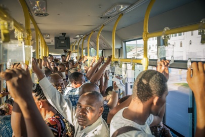
City Bus, Dar Es Salaam


Utilities
Electricity Generation and Transmission
Although Kujenga’s power generation is modest compared to Amari, it has abundant hydroelectric and natural gas sources. Combined, these sources generate almost 80 percent of Kujenga’s electricity. The recent introduction of wind power to the portfolio opens up new possibilities for off-grid and mini-grid power in remote or under-served areas. While about 60% of Dar Es Salaam residents are connected, other urban connection rates are closer to 30%. Kujenga has 18 operational power plants generating 1,400 MW, with another 675 MW of capacity under construction and expected to come on line in the near-term. None of the operating plants have an output greater than 250 MW, and over 60 percent are under 100 MW. For reference, the average American coal-fired power plant generates over 500MW.
Additional natural gas deposits on the Indian Ocean coast present opportunities for Kujenga to increase its generating capacity if an economical transmission system is in place.
Water
The majority of Kujenga’s terrain drains into Lake Tanganyika, which drains to the Congo River. The rest drains to either the Indian Ocean, or Lake Victoria, which in turn drains to the Nile River. Kujenga is a member of the Nile Watershed Congress, an intergovernmental organization chartered to address access, irrigation, hydroelectric power, and environmental issues related to the Nile. This international agreement restricts upstream irrigation and hydroelectric projects. Downstream members must be approve these projects.
Over thirty percent of Kujenga’s population has access to piped water – mostly from neighborhood standpipes. In the cities, twice as many residents get their water from neighbor’s taps versus public standpipes. Rural census data is less complete than Amari, however, a comprehensive list of borehole/spring locations corroborates the conclusion that proportionately less of Kujenga’s population is reliant on standing water or vendors.

Transportation Architecture
Roads
(Below excerpt from WFP “Logcluster”, https://www.wfp.org/logistics/cluster adapted to Kujengqa from Tanzanian data)
The Kujenga Road Authority (KRA) maintains both trunk and regional roads. District, urban and feeder roads are the responsibility of the Office for Regional Administration (ORA). Road weight limits are currently 9.000 kg/axle, with a maximum of seven axles or 56,000 kg per vehicle. The most recent overall road condition assessment indicated that 73% were good, 23% were fair and 4% were poor. A slim majority of the trunk roads are paved, with noticeable gaps in the southeast and northwesterly quadrants. The attached map and list describe the current conditions of Kujenga’s trunk and regional road networks.
Destinations close to tarmac roads are easily accessible even with trucks of over 30 metric tons; otherwise, they cannot be accessed with trucks of over 15 metric tons. Those destinations are thus mostly served by trucks between 10 to 12 metric tons. During rainy seasons, tractors and four-wheel pick-ups are preferable, which in turn adds to the cost of transport.
There are no bridges or tunnels that impact movement of traffic transported by in-gauge roads. Abnormal and out-of-gauge traffic requires route surveys and permission from Kujenga Road Authorities, Police and other relevant authorities.
Rail
Kujenga’s rail capacity is second to Amari in the region, measured by track network and rolling stock. It significantly lags behind Amari, however, in track and depot maintenance and rehabilitation. Dual-gauge is a main feature of Kujengan rail: the central corridor line and spurs are meter gauge, while the north-south line is “Cape Gauge” (1,067mm). Like Amari and the other regional countries, the prospect of better access to Africa’s interior markets motivates foreign investment in rail development. In the case of Kujenga, that means an east-west corridor from Kigoma and Mwanza to an upgraded port of Tanga, just north of Dar Es Salaam. The planned rail line is standard gauge, as are all planned rail upgrades throughout the region.
Anticipated cargoes for the east-west routes are containerized freight and bulk agricultural exports. Mineral ores and mining materials account for most of the north-south traffic. Due to maintenance issues driving schedule problems, the rail network only carries approximately five percent of Kujengan freight; most is carried over the steadily-improving road network.
Major rail yards are located in Dar Es Salaam, Tabora, Kigoma and Mbeya. A transloading terminal in Kidatu services branches on both gauges.
As with other transit networks, Kujenga’s rail is focused on east-west transit from Indian Ocean ports to the landlocked interior competing with Amari, rather than on north-south cooperation optimal for a trans-African transport system. In particular, a disused 1,000mm gauge rail route from Tanga to Voi, Amari could be a key link in such a north-south corridor.
Aviation
Dar Es Salaam is the national air hub and the main gateway to the tri-state tourism region in the north. Zanzibar is also a major tourist destination, with regular regional air service to Nairobi, Arusha, and Kampala. The southernmost airport of significance is Mbeya; only two paved airports service southwest Kujenga.
Kujenga has one state-run regional carrier that operates smaller commuter airliners servicing sub-Saharan capitals and regional airports. Regular passenger service links Dar Es Salaam, Zanzibar, Tanga, Dodoma, Mtwara, Songea, Mbeya, Iringa, Morogoro, Sumbawamba, Kigoma, and Tabora. Numerous charter companies serve these same destinations, with outlying primitive fields used by safari companies and non-governmental service organizations.
Maritime Sea ports
Kujenga has 6 seaports located along Africa’s east coast. There is only 1 Kujenga port that average more than 1 million tons of cargo throughput annually. There are no Kujenga ports that can accommodate Military Sea Lift (MSC) Commands Large, Medium-Speed Roll-on/Roll-off (LMSR). Kujenga’s Ports Authority (KPA) is a parastatal public corporation acting under the aegis of the Ministry of Infrastructure Development, that has the responsibility "to manage and operate" the ocean ports and lake ports of the country of Kujenga. The Kujenga Ports Authority headquarters are located in Kurasini Dar es Salaam. It is a member of the Port Management Association of Eastern and Southern Africa.

The Port of Dar es Salaam is the principal port of Kujenga and handles 90% of the countries cargo traffic. The port is divided into two parts (TICTS and TPA), to increase efficiency and encourage new challenges to the local port operators the TPA has authorized TICTS privately owned by Hong Kong investors to receive and clear cargo at the port. The Port also provides a vital transit point for cargo from multiple neighboring landlocked countries. Almost 35 percent of all cargo moving through the port is transit cargo. The port is connected to two railways the Tanzania Central Railway and the TAZARA Railway, however the railways have been depreciating in reliability. The majority of the cargo moves out by road and has been a major bottleneck in expansion plans due to the weak road infrastructure of the city. Major expansion projects have been set in place to increase the capacity and efficiency of the port. After the construction of the Kigamboni Bridge in the city the port plans to create more berths in Kigamboni. Furthermore, the construction of the Bagamoyo mega port has also begun set to help take the load off in 2018.
The Port of Tanga is one of the oldest operating port in the country and was built by the German East Africa Company as the endpoint of the Usambara Railway. The port is the second largest port operating in the country and has an annual capacity of 500,000 tons and is running at 90% capacity. The Ports authority has major plans to upgrade the port increase capacity and provide an alternative route for cargo flowing into the country. The port of Mtwara was built during the British Colonial times. The harbor at the Port of Mtwara was deepened during 1948–1954, and railway line was built connecting the port, as part of the Tanganyika groundnut scheme. The port was functional but underused for many years due to poor transport infrastructure, However, in the years of 2010–2011 when oil and gas exploration activity caused a surge on operations. In December 2015 Alistair Freeport Limited injected $700,000 to construct an export processing zone around the port area.
.
.
.

.
.
.
.
.
.
.
.
.
Petroleum Pipeline and Storage System
Kujenga’s current petroleum infrastructure was designed to import crude oil to Dar Es Salaam, then transfer inland to southern African countries for refining via a pipeline generally following the Southeast Corridor. A former refinery in Dar Es Salaam now provides the bulk of Kujenga’s storage capacity. All refined petroleum products are imported – mainly from overseas and trucked from Dar Es Salaam. Private interests are competing to build a pipeline from Hoima in Amari, south through Bukoba on the western shore of Lake Victoria. Depending on the progress of an Amari refinery, a crude pipeline could be extended to Tanga, or a product terminal could be developed in western Kujenga to serve the domestic market or further shipment south.
Liquefied Petroleum Gas
Commercial companies provide licensed liquefied petroleum gas (LPG) storage and handling services. The major coastal terminals are listed in Table 12. Additionally, inland facilities are located in Mbeya, Iringa, Dodoma, Morogoro, Ruvuma, Njombe, Singida, manyara, Geita, Kagera and Kigoma. There is a brisk business in unlicensed LPG distribution and kerosene/diesel smuggling.
Pollution
Kujenga’s main sources of water pollution are human waste, industrial and fertilizer chemical runoff, and mine tailings. The latter is most pronounced at unauthorized mining sites.