
Difference between revisions of "Amari Infrastructure"
m (→Major Cities and Urban Zones: Removed duplicate city population and density data.) (Tag: Visual edit) |
|||
| Line 1: | Line 1: | ||
| − | + | <div style="font-size:0.9em; color:#333;" id="mw-breadcrumbs">[[Africa|DATE Africa]] > [[Amari]] > '''{{PAGENAME}}''' ←You are here</div> | |
[[File:Amari_infrastructure.png|thumb|Amari Infrastructure]] | [[File:Amari_infrastructure.png|thumb|Amari Infrastructure]] | ||
Amari has over twice the population of Texas but less than five percent of its electrical power generating capacity. Despite that, Amari is still the regional leader in the depth and quality f its infrastructure. The key features are the port of Mombasa and the ''Northern Victoria Corridor (NOVIC)'' connecting Mombasa to Nairobi and points west. The corridor also serves the resource-rich Lake Victoria region, with a spur to Kisumu and a direct line to Kampala. Nairobi is also the region’s major air hub for international trade and tourism. | Amari has over twice the population of Texas but less than five percent of its electrical power generating capacity. Despite that, Amari is still the regional leader in the depth and quality f its infrastructure. The key features are the port of Mombasa and the ''Northern Victoria Corridor (NOVIC)'' connecting Mombasa to Nairobi and points west. The corridor also serves the resource-rich Lake Victoria region, with a spur to Kisumu and a direct line to Kampala. Nairobi is also the region’s major air hub for international trade and tourism. | ||
| Line 1,248: | Line 1,248: | ||
Population growth in the Lake Victoria area threatens the water quality of the lake and downstream on the Victoria Nile and Albert Nile. The largest contributors are raw sewage, solid waste, and chemical run-off. Additionally, the northern lake ports suffer from extensive algae and vegetation blooms. | Population growth in the Lake Victoria area threatens the water quality of the lake and downstream on the Victoria Nile and Albert Nile. The largest contributors are raw sewage, solid waste, and chemical run-off. Additionally, the northern lake ports suffer from extensive algae and vegetation blooms. | ||
| − | Lack of government regulation on tailpipe and industrial emissions create a growing air pollution problem in the cities, especially Nairobi and Kampala. City water pollution is proportional to lack of wastewater management. Areas with large informal settlements suffer the most as the effluent enters the watershed. | + | Lack of government regulation on tailpipe and industrial emissions create a growing air pollution problem in the cities, especially Nairobi and Kampala. City water pollution is proportional to lack of wastewater management. Areas with large informal settlements suffer the most as the effluent enters the watershed. |
[[Category:DATE]] | [[Category:DATE]] | ||
[[Category:Africa]] | [[Category:Africa]] | ||
[[Category:Amari]] | [[Category:Amari]] | ||
<references /> | <references /> | ||
Revision as of 17:58, 4 January 2019

Amari has over twice the population of Texas but less than five percent of its electrical power generating capacity. Despite that, Amari is still the regional leader in the depth and quality f its infrastructure. The key features are the port of Mombasa and the Northern Victoria Corridor (NOVIC) connecting Mombasa to Nairobi and points west. The corridor also serves the resource-rich Lake Victoria region, with a spur to Kisumu and a direct line to Kampala. Nairobi is also the region’s major air hub for international trade and tourism.
Amari wishes to maintain its advantage over Kujenga’s port of Dar Es Salaam and the Dar Es Salaam-Kigoma (DARGOMA) Corridor. It also understands the importance of streamlined border and customs control to regional security and economic development.
Despite abundant petroleum, geothermal, and hydroelectric resources, most Amaris depend on wood or charcoal for cooking, and oil lamps for lighting. Even those living in cities serviced by electric or water distribution grids are not necessarily connected to those systems.
Contents
Major Cities and Urban Zones
See Also: Regional Construction Patterns for a comparative summary.
| City | Est Pop (2017) | Pop Dens/km2 | UBD | Rd | Air | Rail | Sea | Pwr | Wtr | Sani |
|---|---|---|---|---|---|---|---|---|---|---|
| Nairobi | 4,089,493 | 6,963 | H | M | C | P+ | n/a | Dv | Dv | Dv- |
| Kampala | 1,603,584 | 8,436 | H | M | C | P | M | Dv | Dv | Dv |
| Mombasa | 1,156,632 | 5,281 | H | P | M | P+ | C | Dv | Dv | Dv |
| Kisumu | 552,064 | 850 | M- | P | M | P | M | Dv | Dv | Dv |
| Arusha | 542,064 | 5,635 | M | P | M- | P | n/a | Dv | Dv | Dv |
Legend (per TC-7-101): (UBD) urbanized building density, (L) low, (M) medium, (H) high, (P) primitive, (M) moderate, (C) complex, (NE) non-existent, (Dg) degraded, (Dv) developed
Amari’s population is most dense between Nairobi and Kampala. The rural east and its inland border with Kujenga are more sparsely populated than the western rural areas north of Lake Victoria. Nairobi and Kampala are the largest and most developed cities; Kisumu, the historic port city of on Lake Victoria, is Amari’s capital.
Nairobi

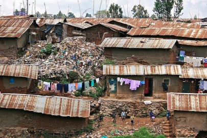
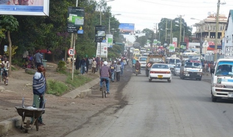
Nairobi has grown from a rural cattle market to the regional economic power. Dense low-rise residential areas and intermixed light industry surround a modern, high-rise, closed-block city center. Over half of Nairobi’s inhabitants live in informal settlements, e.g. Kibera, Starehe, Kamukunji, and Makadara. These areas are more than twice as dense as the city average. This pattern is similar in the other large Amari cities. The city limits also include a 29 thousand acre national park.
Open space comprises the largest land use in Nairobi (47.8%), followed by residential (15.1%), and national park (13.9%). Land use changes include: i) soil rich farmland to residential area, ii) grassland to residential area, iii) detached house to apartment or office, and iv) river bank to informal settlements.
Kampala

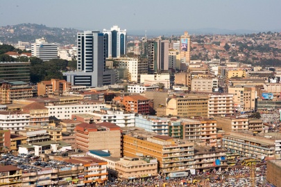
With a greater metropolitan population over 3 million, Kampala is the largest city on Lake Victoria, as well as one of the oldest. Kampala’s adjacent Port Bell is the major northern terminus of the Lake Victoria Rail Ferry, serving western Amari and landlocked states to the north and west. Kampala is also the commerce and cultural center of western Amari, its importance increasing since the Albertine Basin oil discoveries.
Similar to Nairobi, Kampala has a relatively modern city center surrounded by dense high-rise residential blocks. Kampala is built on a series of hills. Higher income residences and business occupy the high ground, surrounded by lower income low-rise closed blocks. Dense shantytowns and informal settlements in turn surround these blocks.
Mombasa

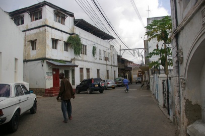
Established as an Arab trading port in 16th Century, Mombasa retains much of its old city center in a small urban core on Mombasa Island. This dense random construction of two and three story stone and wood structures includes some early 20th Century closed block construction. Mombasa has neither the infrastructure endowment, nor the widespread slums associated with Nairobi or Kampala.
Most commerce and industry surrounds the port of Mombasa on island’s west side, and across Kilindini Harbor. The western suburbs include Amari’s principal naval base and a large dual-use airport. The east and north sides of Mombasa contain mostly low density, low-rise residences and resort properties. The southeastern community of Likoni is a mainly high-density semi-organized shantytown.
Arusha

Arusha is the gateway city for Amari’s significant safari and ecotourism industry, with Mt. Meru and Mt. Kilimanjaro to the east, and the Ngorogoro Crater and Olduvai Gorge to the west. Arusha is served by a spur rail line from Dar Es Salaam, with plans for direct connection to Nairobi and points west. The easterly rail line to Voi is abandoned.
The construction pattern is mostly closed block, with a modest mid-rise city core. The surrounding commercial areas resemble more strip construction than closed block core periphery.
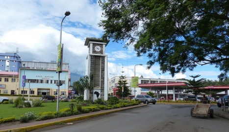
Kisumu

Kisumu was an early colonial rival to Kampala. It retained its status as Amari’s capital, though it does not have the infrastructure or economy of Kampala. Kisumu is a spur of off the Nairobi-Kampala section of the Northern Victoria Corridor, linked by paved but secondary roads and rail. It is also a northern terminus of the Lake Victoria rail ferry with service to Kampala in the west, and Mwanza, Ziwa to the south. The construction pattern is mostly shantytown, split evenly between dense informal settlement and more scattered lots with tiny farm plots. Otherwise, the city center is close orderly block construction with an east-west strip area following the B1 Kisumu-Busia main road.
Image Gallery
Downtown Nairobi, Photo: Mwangi Kirubi (CC BY-NC 2.0)
Outskirts of Nairobi, Photo: Mwangi Kirubi (CC BY-NC 2.0)
Kibera Slum, Photo: Colin Crowley (CC BY-SA 2.0)
Kampala Skyline, Photo: Lauren Parnell Marino (CC BY-NC 2.0)
Arusha Street, Photo: Roman Boed (CC BY 2.0)
Arusha City Center, Photo: Roman Boed (CC BY 2.0)
Mombasa Street, Photo: chiefmoamba via Flickr (CC BY-NC-ND 2.0)


Utilities
See Also: Regional Utilities for a comparative summary.
| Country | Lighting
(Elect) |
Cooking
(Gas,Elect) |
Cooking
(Wood, Charcoal) |
Water
(Piped)1 |
Water
(Well, Spg) |
Improved
Sanitation2 |
Basic
Latrine |
|---|---|---|---|---|---|---|---|
| Amari | 22 | 4 | 93 | 23 | 35 | 8 | 80 |
| Ziwa | 15 | 5 3 | 95 | 20 | 25 | 10 | 85 |
| Kujenga | 19 | 5 3 | 93 | 40 | 38 | 19 | 70 |
| Nyumba | 5 | 2 | 97 | 11 | 22 | 6 | 61 |
Notes: 1. includes piped water from neighbor 2. sewer, septic, or ventilated improved pit latrine 3. urban pct.
Electricity Generation and Transmission
DATE Africa Regional Infrastructure#Regional Electricity Generation and Transmission
Amari currently has over 60 operational power plants generating 4,120 MW. Another 2,700 MW of capacity is either under construction or planned. None of the operating plants are over 250 MW, and over 60 percent are under 100 MW. For reference, the average American coal-fired power plant generates over 500MW.
Amari generates more than half of its electricity from a combination of hydroelectric and geothermal sources, exporting modest surplus power to Nyumba and Ziwa. Over half of the urban population has access to electricity, though the grid fails to keep up with peak demands. The lack of peak generating capacity, and transmission line repair and expansion account for most power outages.
Potential natural gas deposits on the Indian Ocean coast present opportunities for Amari to convert coal-fired plants or increase its generating capacity if an economical transmission system is in place.
| Name | Capacity (MW) | Source | Latitude | Longitude |
|---|---|---|---|---|
| Bujagali | 250 | River Nile | 0.4975N | 33.1400E |
| Kiira | 200 | River Nile | 0.4506N | 33.1858E |
| Olkaria I Geothermal | 185 | GeoTh | 0.8933S | 36.3083E |
| Nalubaale | 180 | River Nile | 0.4436 N | 33.185E |
| Olkaria IV Geothermal | 140 | GeoTh | 0.8636S | 36.3000E |
| Olkaria III Geothermal | 110 | GeoTh | 0.8750S | 36.3000E |
| Nairobi South Thermal | 109 | Heavy fuel oil | 1.2830S | 36.8170E |
| Olkaria II Geothermal | 105 | GeoTh | 0.8636S | 36.3000E |
| Rabai Thermal | 90 | Heavy fuel oil | 3.9330S | 39.667E |
Image Gallery
Biogas Power Plant, Photo: US Embassy Dakar
Olkaria Gate Geothermal Complex, Photo: Jon Fisher (CC BY-NC-ND 2.0)


Water
For more information, see Amari Physical Environment page and DATE Africa Regional Infrastructure page
| Water Supply | Amari | Kujenga | Nyumba | Ziwa |
|---|---|---|---|---|
| Piped Household | 6 | 4 | 5 | 5 |
| Piped Other (Standpipe) | 20 | 30 | 6 | 40 |
| Spring/Well/Borehole | 41 | 38 | 22 | 35 |
| Surface(Lake/River/Stream) | 28 | 26 | 65 | 10 |
| Vendor | 4 | - | - | 10 |
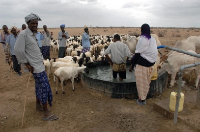
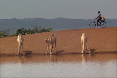
Unfortunately, less than a quarter of the population has access to household piped water, with most relying on standposts, wells, or boreholes. Increasing urbanization rates are dropping the proportion of city residents with access to piped water networks. In rural communities, over forty percent rely on lakes or streams for water.
Most agriculture relies on rain, with less than four percent of the potential acreage under irrigation.
Image Gallery
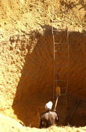
Improved Rural Well, Nyumba. USAF Photo: MSgt Eric Kreps
Reservoir, Amari. USN Photo: MC2 Roger S. Duncan


| Name | Ht (m) | Cap (Mm3) | Lat | Long | Opnl | Use | Remarks |
|---|---|---|---|---|---|---|---|
| Bathi | 22 | 0.3 | 00.0878N | 35.6331E | 1980 | Wtr Sup | |
| Chemeron | 31 | 4.6 | 00.43333N | 35.9E | 1984 | Wtr Sup/Irrig | |
| Chemususu | 12 | 00.087784N | 35.6331E | 2014 | Wtr Sup | Eldama Ravine | |
| Ellegirini | 24 | 2 | 00.54167N | 35.16389E | inop | Flood Cont | |
| Ewaso Ngiro | 00.5667N | 36.8667E | prop | Elec | |||
| Gitaru | 30 | 20 | 00.79425N | 37.7523E | 1978 | Elec | |
| Kamburu | 56 | 150 | 00.81222S | 37.68833E | 1974 | Elec | |
| Kiambere | 112 | 585 | 00.6411S | 37.91056E | 1987 | Elec | |
| Kikoneni | 16 | 1.26 | 04.3333S | 39.16667E | 1981 | Wtr Sup | |
| Kindaruma | 24 | 16 | 00.80639S | 37.81E | 1968 | Elec | |
| Kirindich | 50 | 3 | 00.49702N | 35.78174E | 2000 | Wtr Sup | |
| Kiserian | 1.22 | 01.43731S | 36.6974E | 2012 | |||
| Low Grand Falls | 00.43333S | 37.93333E | prop | Elec | aka Kibuka Falls, Proposed | ||
| Magwagwa | 00.486S | 35.0352E | prop | Elec | Proposed | ||
| Manooni | 16 | 0.41 | 01.95120S | 37.47049E | 1987 | Wtr Sup | |
| Masinga | 70 | 1,560 | 00.87861S | 37.58917E | 1980 | Flood Cont/Elec | |
| Mukurumudzi | 24 | 8.5 | 04.4054S | 39.431E | 2013 | Mining | Supply of mining industry (Titanium and zircon) |
| Mulima | 17 | 0.275 | 01.53333S | 37.33889E | 1982 | Wtr Sup | |
| Muoni | 22 | 0.83 | 01.4055S | 37.33535E | 1987 | Wtr Sup | |
| Mutonga | 5400 | 00.4247S | 37.9218E | prop | Elec | Proposed | |
| Mwache | 03.9450S | 39.51061E | comp | Wtr Sup | |||
| Ruiru | 23 | 2.98 | 00.88333S | 36.6E5 | 1949 | Wtr Sup | |
| Sasumua | 45 | 13.25 | 00.7606S | 36.68194E | 1956 | Wtr Sup | |
| Sondu Miriu | 18 | 00.3464S | 34.8523E | 2009 | Elec | ||
| Tana | 00.78S | 37.27E | 2009 | Elec | |||
| Thika | 63 | 70 | 00.82S | 36.85E | 1993 | Wtr Sup | |
| Turkwel | 155 | 1645 | 01.915N | 35.34639E | 1991 | Elec | |
| Ayago North | 01.816667N | 32.46666E | prop | Elec | Proposed | ||
| Bujagali | 0.75 | 00.49694N | 2012 | Elec | |||
| Bygoe | 00.3090N | 30.09807E | comp | Elec | |||
| Ishasha River | 00.8814S | 29.67E | comp | Elec | Aka Kanungu Hydro | ||
| Isimba | 00.7704N | 33.0405E | 2016 | Elec | |||
| Kalagala | 00.5962N | 33.0521E | prop | Elec | Proposed | ||
| Karuma Falls | 02.2667N | 32.25E | u_const | Elec | Under Construction | ||
| Kiira | 00.4501N | 33.1861E | comp | Elec | 3 Dam complex Owen/Narubale/Kilra | ||
| Masindi I | 01.66672N | 31.71664E | prop | Elec | Proposed | ||
| Mubuku-3 | 00.1667N | 30.E1 | prop | Elec | Proposed | ||
| Muzizi | 01.0244N | 30.5236E | prop | Elec | Proposed | ||
| Narubale | 00.4432N | 33.1852E | comp | Elec | 3 Dam complex Owen/Narubale/Kilra | ||
| Owen Falls | 30 | 80000 | 00.44583N | 33.1875E | 1954 | Elec | 3 Dam complex Owen/Narubale/Kilra |
| Mwwambe | 04.4431S | 39.46128E | comp | Wtr Sup | Adj to Mukurumudzi Dam | ||
| Nyumba Ya Mungu | 42 | 870 | 03.61S | 37.45806E | 1966 | Wtr Sup |
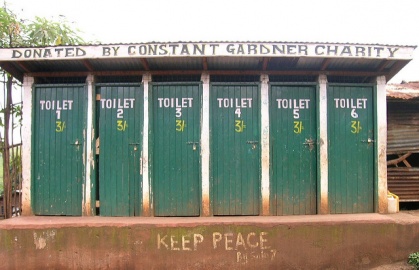
Sanitation
Traditional and improved latrines make up the largest sanitation method. In some rural districts, less than forty percent of the population can access improved sanitation. While major cities can claim 50 percent sewer connection rates, the average city sewer reaches less than twenty percent of its population.
Image Gallery
Kibera Latrine, Photo: Antonella Sinopoli (CC BY-NC-ND 2.0)
Latrine Construction, Photo: USAF, Capt. Mike Harper


Transportation Architecture
See Also: Regional Transportation for a comparative summary.
Roads
DATE Africa Regional Infrastructure#Regional Roads
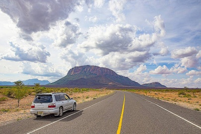
Amari classifies its roads with the standard trunk, secondary, tertiary or track designations. Most trunk roads are hard-surfaced except for those on the coast north of Mombasa and east of the Moyale-Nairobi north-south artery. On average, thirty percent of these roads are in poor condition, requiring rehabilitation beyond routine maintenance. Most improved roads are traversable in all weather conditions. The vast network of undesignated rural roads and tracks comprise 150-200% of government road networks and carry up to one third of agricultural output.
Traffic on roads outside of the cities is sparse, mostly commercial trucks.
| City Pair | Desig | Class | Dist. (Mi) | Surface | Condition |
|---|---|---|---|---|---|
| Bukoba-Kampala | T4 | A | Asphalt | ||
| Mombasa-Voi | A109 | A | Asphalt | ||
| Voi_Nairobi | A109 | A | Asphalt | ||
| Nairobi-Nakuru | A104 | A | Asphalt | ||
| Nakuru-Eldoret | A109 | A | Asphalt | ||
| Eldoret-Tororo | A104 | A | Asphalt | ||
| Eldoret-Matete | A104 | A | Asphalt | ||
| Matete-Kisumu | A1 | A | Asphalt | ||
| Tororo-Kampala | A109 | A | Asphalt | ||
| Isiolo-Nyeri | A2 | A | Asphalt | ||
| Nyeri-Thika | A2 | A | Asphalt | ||
| Thika-Nairobi | A2 | A | Asphalt | ||
| Nairobi-Namanga | A104 | A | Asphalt | ||
| Namanga-Arusha | A104/T2 | A | Asphalt | ||
| Arusha-Taveta | A23/T2 | A | Asphalt | ||
| Taveta-Voi | A23 | A | Asphalt | ||
| Mombasa-Horo Horo | A14 | A | Asphalt | ||
| Taveta-Voi | A23 | A | Asphalt | ||
| Horo Horo-Tanga | A13 | A | Asphalt | ||
| Thika-Garissa | A3 | A | Asphalt | ||
| Nakuru-Kericho | B1 | B | Asphalt | ||
| Kericho-Kisumu | B1 | B | Asphalt | ||
| Malindi-Mombasa | B1 | B | Asphalt |
Image Gallery
New Section of Amari A2. Photo: Mwangi Kirubi (CC BY-NC 2.0)
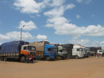
Typical Border Crossing. Photo: USAID West Africa Trade Hub
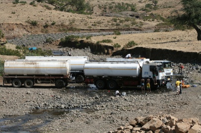
Tanker Truck, Eastern Amari. Photo: Northern Corridor Transport Observatory


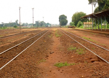
Rail
DATE Africa Regional Infrastructure#Regional Rail
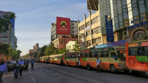
Amari is the regional leader in railway improvement. New standard gauge rail runs from Mombasa to Nairobi, with the Nairobi-Kampala segment currently under construction. Current construction is mostly financed and built by Olvanese companies. General freight and container traffic are the main users, however, the government expects passenger use to increase as fares and travel times become competitive with bus transport.
Major rail yards are located in Mombasa, Nairobi, and Kampala. Mombasa and Kampala's rail lines run directly to the port facilities.
Image Gallery
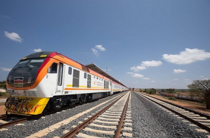
New Standard Gauge Train Mombasa-Nairobi Line Photo: Mwangi Kirubi (CC 2.0 BY-NC)
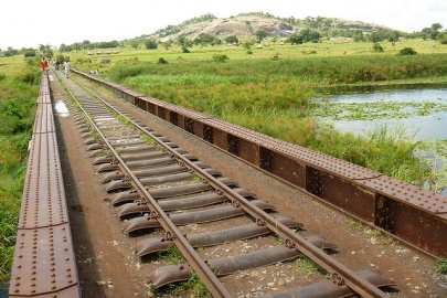
Meter Gauge Bridge Photo: US Army Africa
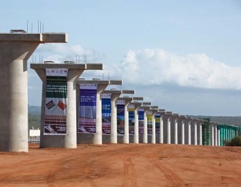
Amari-Olvaria Standard Gauge Rail Project Photo: Ref#8
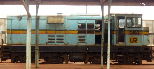
Meter Gauge Locomotive, Northwestern Amari Photo: US Army Africa
Ageing Meter Gauge Track, Northwestern Amari Photo: US Army Africa


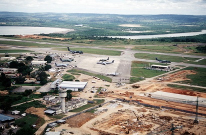
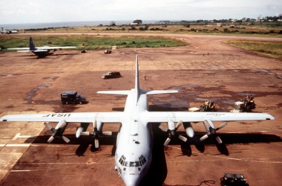
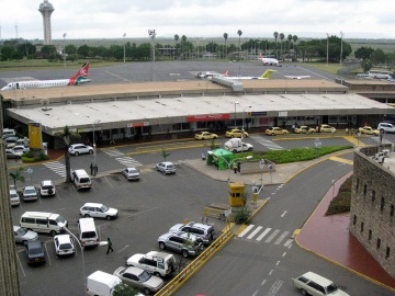
Aviation
DATE Africa Regional Infrastructure#Regional Aviation
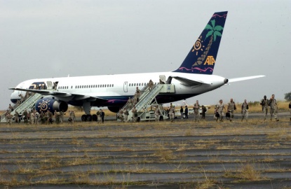
Nairobi is the regional air hub. Amari also has a successful state-controlled airline, Amari Airways, which recently upgraded their aircraft fleet. Amari handles over fifteen percent of Africa’s air cargo traffic, with Europe being the primary destination. Counter-seasonal flowers and perishables are the largest commodities.
| City | Name | Desig | Lat | Long | Elev (ft) | Lngt (ft) |
|---|---|---|---|---|---|---|
| Nairobi | Jomo Kenyatta Intl. | HKJK | 01.31924S | 36.92780E | 5,330 | 13,507 |
| Nanyuki | Laikipia Air Base | KE-0075 | 00.03293N | 37.02690E | 6,119 | 13,123 |
| Mombasa | Mombasa Moi Intl | HKMO | 04.03483S | 39.59420E | 200 | 10,991 |
| Gulu | Gulu Apt. | HUGU | 02.80556N | 32.27180E | 3,510 | 10,314 |
| Nairobi (Eastleigh) | Moi Air Base | HKRE | 01.27727S | 36.86230E | 5,336 | 7,998 |
| Kampala | Entebbe Intl | HUEN | 00.04239S | 32.44350E | 3,782 | 7,900 |
| Kisumu | Kisumu Apt | HKKI | 00.08614S | 34.72890E | 3,734 | 6,511 |
| Soroti | Soroti Apt | HUSO | 1.72769N | 33.6228E | 3,697 | 6,100 |
| Narok | Narok Apt | HKNO | 01.15000S | 35.76700E | 6,070 | 6,001 |
| Nakuru | Nakuru Apt | HKNK | 00.2981S | 36.1593E | 6,234 | 5,607 |
| Arusha | Arusha Apt | HTAR | 03.36779S | 36.63330E | 4,550 | 5,377 |
| Chake | Pemba Apt | HTPE | 05.25726S | 39.81140E | 80 | 5,003 |
| Nairobi | Wilson Apt | HKNW | 01.32172S | 36.31480E | 5,536 | 5,052 |
Image Gallery
Daniel Arap Moi Intl., Mombasa. Photo: US Govt.
Entebbe Intl. Photo: US Govt.
Entebbe Facilities. Photo: US Govt.
Jomo Kenyatta Intl. USAF Photo: SSgt Nic Raven
Jomo Kenyatta Intl. Airport, Nairobi
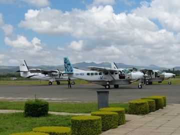
Charter/Regional Aircraft, Arusha Airport. Photo: Roman Boed (CC BY 2.0)


Maritime
DATE Africa Regional Infrastructure#Transportation Architecture
| Name | Lat | Long | Channel Depth (ft) | Anchor Depth (ft) | Cargo Pier Depth (ft) | Max Vessel Length (ft) |
|---|---|---|---|---|---|---|
| Chake Chake | 05.2500S | 39.7667E | 46-51 | 41-45 | na | <500 ft |
| Malindi | 03.21670S | 40.13333E | na | 36-40 | na | <500 ft |
| Kilifi | 03.63333S | 39.86667E | 11-15 | 46-51 | 31-35 | <500 ft |
| Mombasa | 04.06667S | 39.66667E | 46-51 | 21-25 | 31-35 | >500 ft |
| Kisumu | 00.10307S | 34.74496E | <500 ft | |||
| Entebbe | 00.05600N | 32.48061E | <500 ft | |||
| Kampala (Port Bell) | 00.28857N | 32.65358E | <500 ft | |||
| Bukakata Ferry Pier | 00.27230S | 32.02630E | <500 ft |
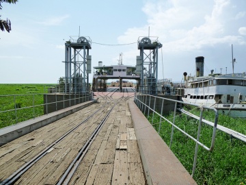
Amari has three ports on the African coastline (Mombasa, Malindi, Kilifi), one on Pemba Island (Chake Chake), and four on Lake Victoria (Kampala, Entebbe, Kisumu, Bukakata). Only Mombasa and Kilifi can service military logistics ships pierside. Only Mombasa and Kampala have rail facilities. The smaller ports transfer cargo from anchored ships via barge, making them compatible with Joint Logistics Over The Shore (JLOTS) operations. Consult NGA Sailing Directions Pub. 171 and the World Port Index for detailed port information.
Additional Port Information
Smaller Amari ports can only support limited Joint Logistics Over The Shore (JLOTS) operations. Limited information provided by investment development authorities is listed below:
Shimoni is situated off Wasini Island, south of Mombasa. The port sits midway along the 4 km channel created by the mainland and Wasini Island. It is primarily a commercial fishing port, processing approximately 10,000MT annually. It is the largest of the coastal small ports. Destinations are mainly Pemba Island and Zanzibar. Improved infrastructure, channel dredging and upgraded navigation aids would optimize its commercial trade potential.
Malindi Malindi Port is situated in Malindi town 120km north of Mombasa. The Port consists of a pier which is in a sound condition and is used as a landing site in the unsheltered sea mainly to serve local fish industry. However, as a result of accretion, the breaking zone has shifted to the pier’s fish landing site. There is a jetty for fish landing on the beach handling approximately 1,250MT per year and 8,000 tourist boat moves.
Ngomeni Ngomeni has a potential to develop as a second port of Amari. The Port is currently handling about 550MT of fish, which is about 1,500kg per day. It also handles about 1,500MT of coastal trade merchandise comprising various goods. Ngomeni Port has a natural sheltered harbor with good nautical access, 20km North of Malindi. There is an all-weather road to the Mombasa Malindi highway. KPA is planning to acquire land around Ngomeni area and construct a proper jetty for fish handling and coastal trade, with potential to develop into a major port and possibly a Special Economic Zones.
Image Gallery
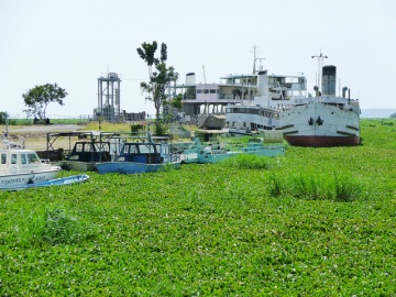
Invasive Water Hiacynth in Kisumu Port.
Commercial Rail Ferry, Kisumu Port. Photo: Richard Portsmouth (CC BY-ND 2.0)
Kilindini Harbor, Mombasa. Photo: US Govt.


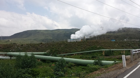
Oil Pipeline, Processing and Terminals
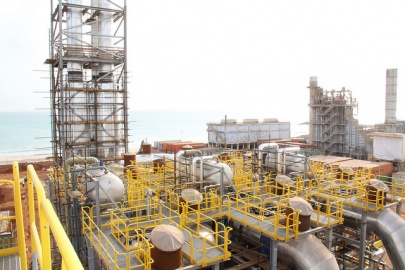
Amari’s current petroleum structure was designed to import crude oil to Mombasa for refining and transfer to the interior via a 14in pipeline generally following the Northern Victoria Corridor. A 12in line from Eldoret to Kampala is under construction. The Mombasa refinery is idle and refined product imports have replaced crude.
A planned refinery in Hoima will process part of the newly discovered oil reserves in western Amari. The complex network of regional customers, foreign investors and public-private partnerships mean that the government will need to consider alternatives to an all-Amari pipeline project. Current proposals envision a southerly pipeline on the west side of Lake Victoria, transiting Kujenga and perhaps Ziwa, and a northeast spur to connect with Nyumba’s "Lamu Port Express",LAPEX, project.


| Section | Length (km) | Dia. (in) | Flow (m3/hr) | Capacity (m3) |
|---|---|---|---|---|
| Mombasa Terminal | Storage | 326,000 | ||
| Mombasa-Nairobi (Line 1) | 450 | 14 | 830 | |
| Nairobi Terminal | Storage | 100,500 | ||
| Nairobi-Nakuru (Line 2) | 325 | 8,6 | 220 | |
| Sinendet-Kisumu (Line 3) | 121 | 6 | 100 | |
| Nairobi-Eldoret (Line 4) | 325 | 14 | 350 | |
| Eldoret-Kampala (Under Const) | 350 | 12 | ||
| Kampala Terminal | Storage | 72,000 | ||
| Sinendet-Kisumu (Line 6) | 121 | 10 | 350 | |
| KOSF-Shimanzi Terminal Spur | 2.8 | 12 | 450 | |
| Changamwe-Moi Int. Apt | 3.8 | 6 | 120 |
Pollution
See Also: Regional Pollution for a comparative summary.
Population growth in the Lake Victoria area threatens the water quality of the lake and downstream on the Victoria Nile and Albert Nile. The largest contributors are raw sewage, solid waste, and chemical run-off. Additionally, the northern lake ports suffer from extensive algae and vegetation blooms.
Lack of government regulation on tailpipe and industrial emissions create a growing air pollution problem in the cities, especially Nairobi and Kampala. City water pollution is proportional to lack of wastewater management. Areas with large informal settlements suffer the most as the effluent enters the watershed.