
File:Map of the Arctic Region.png
From WEG MediaWiki
Size of this preview: 614 × 599 pixels. Other resolutions: 246 × 240 pixels | 675 × 659 pixels.
Original file (675 × 659 pixels, file size: 541 KB, MIME type: image/png)
File history
Click on a date/time to view the file as it appeared at that time.
| Date/Time | Thumbnail | Dimensions | User | Comment | |
|---|---|---|---|---|---|
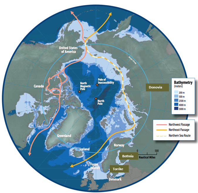
| current | 19:40, 5 September 2018 | | 675 × 659 (541 KB) | Williams.marc (talk | contribs) | Map of the Arctic Region showing the Northern Sea Route and the Northwest Passage. The graphic was created/published by the Arctic Council. Downloaded from https://commons.wikimedia.org/wiki/File:Map_of_the_Arctic_region_showing_the_Northeast_Passage,_... |
- You cannot overwrite this file.
File usage
There are no pages that link to this file.