
File:DATE Europe Islands Map Update.png
From WEG MediaWiki
Revision as of 16:18, 14 September 2018 by Sylvester.vernon (talk | contribs)
Size of this preview: 775 × 600 pixels. Other resolutions: 310 × 240 pixels | 1,760 × 1,362 pixels.
Original file (1,760 × 1,362 pixels, file size: 349 KB, MIME type: image/png)
File history
Click on a date/time to view the file as it appeared at that time.
| Date/Time | Thumbnail | Dimensions | User | Comment | |
|---|---|---|---|---|---|
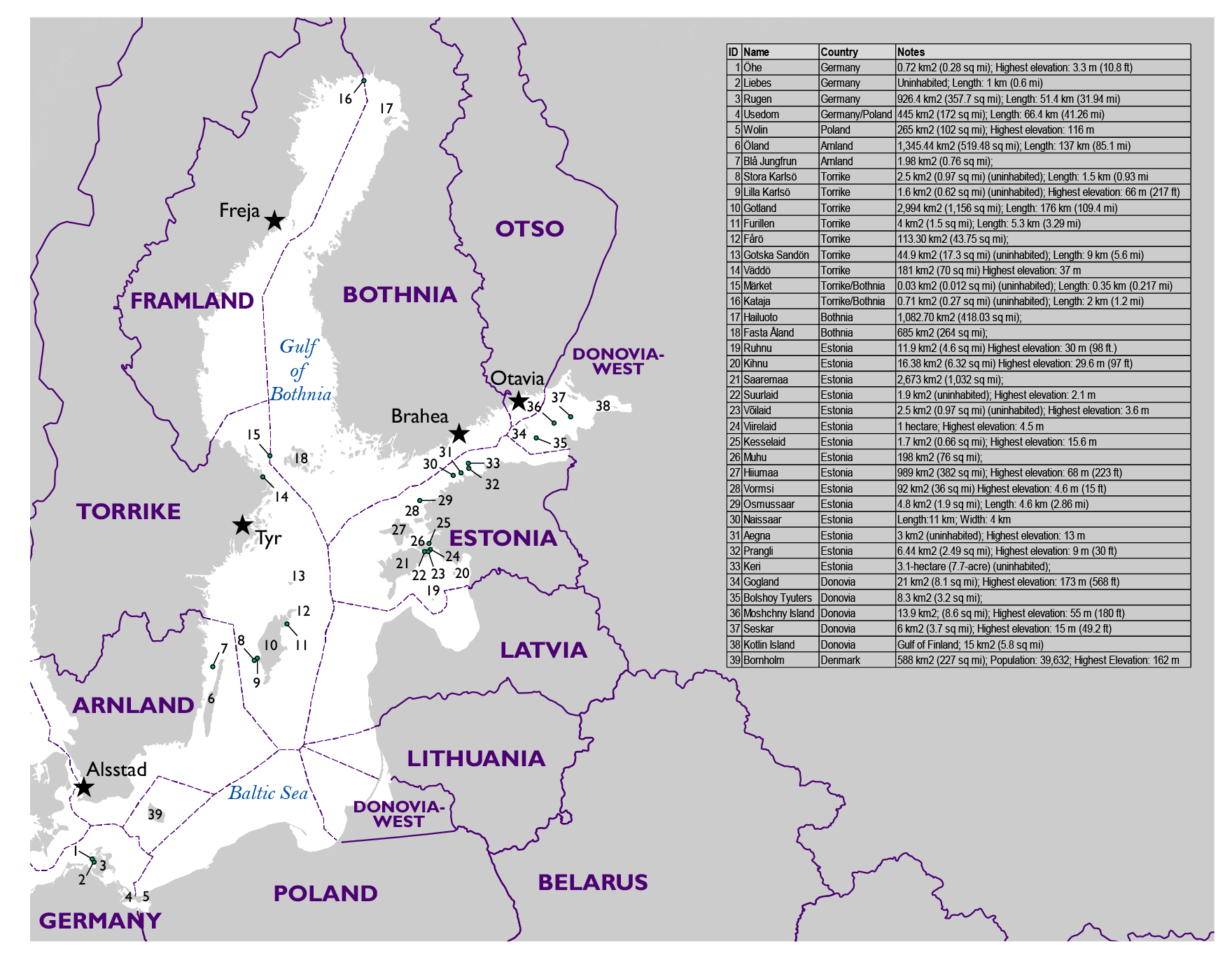
| current | 20:09, 25 September 2018 | | 1,760 × 1,362 (349 KB) | Evans.daniel (talk | contribs) | Clearer table |
| 16:18, 14 September 2018 | 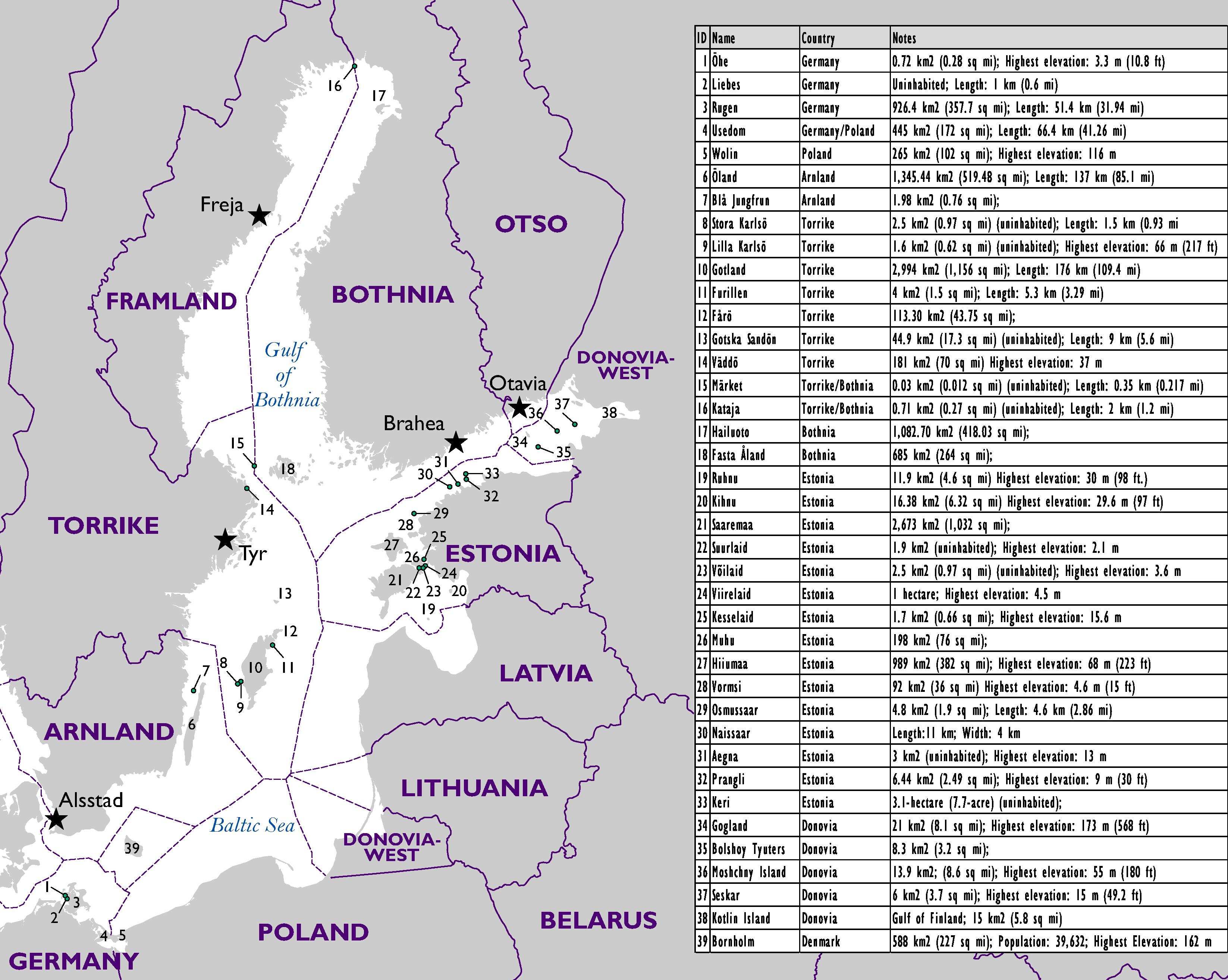 | 3,293 × 2,629 (278 KB) | Sylvester.vernon (talk | contribs) |
- You cannot overwrite this file.
File usage
The following file is a duplicate of this file (more details):
The following 2 pages link to this file: