
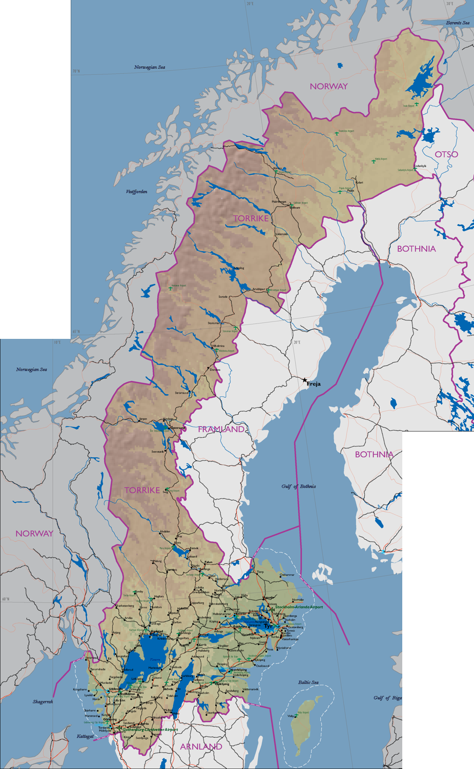
File:DATE Europe Torrike.png
From WEG MediaWiki
Revision as of 15:45, 18 September 2018 by Sylvester.vernon (talk | contribs) (Combined map of Torrike North & South)
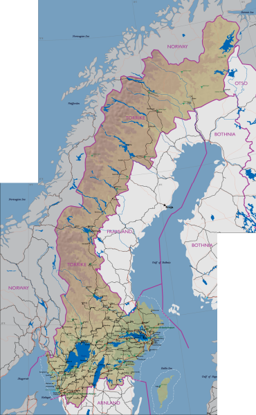
Size of this preview: 370 × 600 pixels. Other resolutions: 148 × 240 pixels | 925 × 1,500 pixels.
Original file (925 × 1,500 pixels, file size: 1.06 MB, MIME type: image/png)
File history
Click on a date/time to view the file as it appeared at that time.
| Date/Time | Thumbnail | Dimensions | User | Comment | |
|---|---|---|---|---|---|
| current | 15:45, 18 September 2018 | | 925 × 1,500 (1.06 MB) | Sylvester.vernon (talk | contribs) | Combined map of Torrike North & South |
- You cannot overwrite this file.
File usage
The following 3 pages link to this file: