
File:Africa Infrastructure Schematicv2.png
From WEG MediaWiki
Revision as of 19:44, 23 April 2018 by Allen.brian (talk | contribs)

Size of this preview: 483 × 600 pixels. Other resolutions: 193 × 240 pixels | 712 × 884 pixels.
Original file (712 × 884 pixels, file size: 114 KB, MIME type: image/png)
File history
Click on a date/time to view the file as it appeared at that time.
| Date/Time | Thumbnail | Dimensions | User | Comment | |
|---|---|---|---|---|---|
| current | 19:57, 20 April 2018 | | 712 × 884 (114 KB) | Allen.brian (talk | contribs) | changed element background and cropped. |
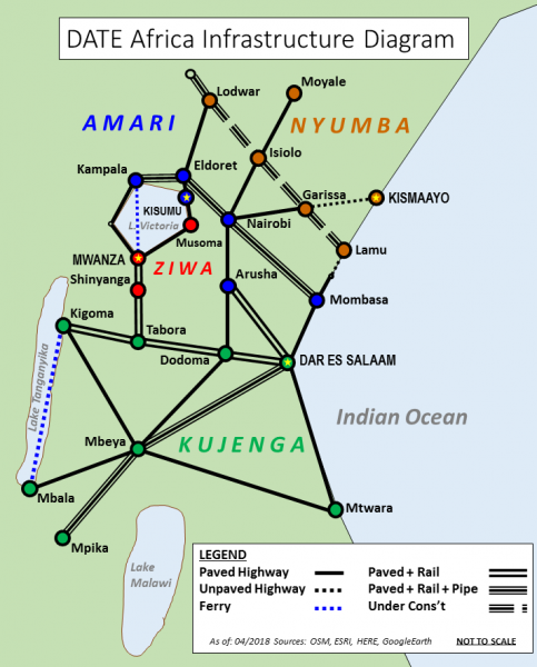
| 22:45, 16 April 2018 | 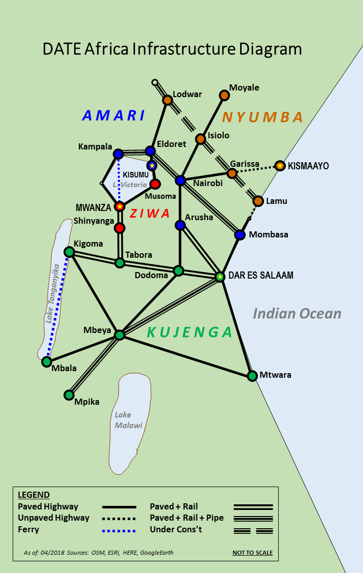 | 715 × 1,127 (120 KB) | Allen.brian (talk | contribs) | New image to replace. gif version since the update feature would not allow a different format to replace the previous version. Original DATE Africa work. Sources as of 04/2018: ESRI, HERE, OSM, GoogleEarth keywords: DATE Africa, infrastructure, map,... |
- You cannot overwrite this file.
File usage
The following 7 pages link to this file: