
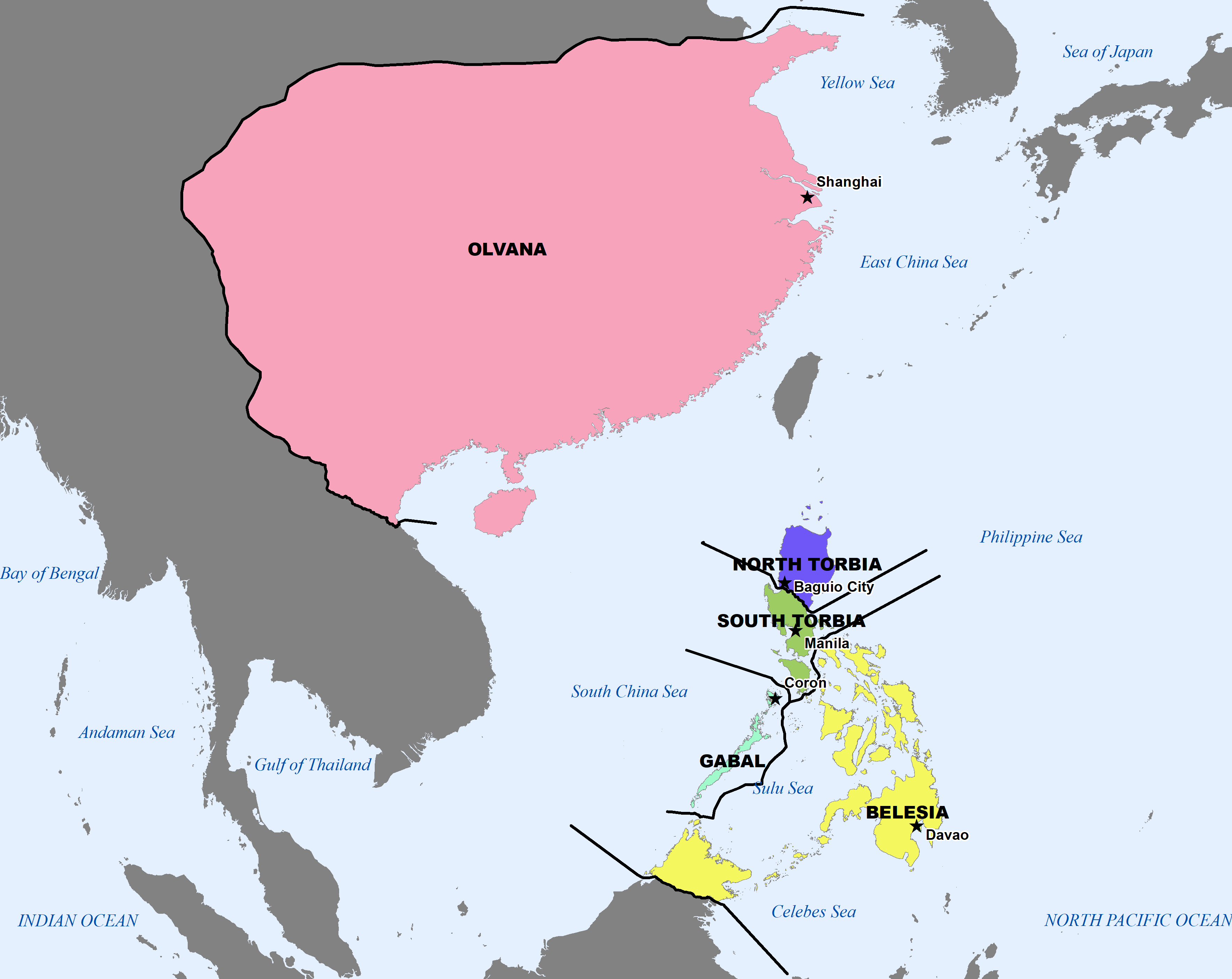
File:DATE-Pacific Map 202101.png
From WEG MediaWiki
Size of this preview: 755 × 600 pixels. Other resolutions: 302 × 240 pixels | 3,531 × 2,806 pixels.
Original file (3,531 × 2,806 pixels, file size: 230 KB, MIME type: image/png)
File history
Click on a date/time to view the file as it appeared at that time.
| Date/Time | Thumbnail | Dimensions | User | Comment | |
|---|---|---|---|---|---|
| current | 16:20, 13 January 2021 | | 3,531 × 2,806 (230 KB) | Pendleton.henry (talk | contribs) | New Map of the entire region |
- You cannot overwrite this file.
File usage
The following 2 pages link to this file: