
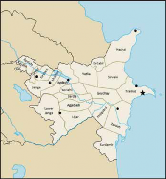
File:Political Subdivisions of Atropia.png
From WEG MediaWiki

Size of this preview: 557 × 600 pixels. Other resolutions: 223 × 240 pixels | 770 × 829 pixels.
Original file (770 × 829 pixels, file size: 447 KB, MIME type: image/png)
File history
Click on a date/time to view the file as it appeared at that time.
| Date/Time | Thumbnail | Dimensions | User | Comment | |
|---|---|---|---|---|---|
| current | 20:13, 21 April 2017 | | 770 × 829 (447 KB) | Wegman (talk | contribs) | Atropia, Political, Branches of Government, Legislative Authority, map, provinces, borders, major cities |
- You cannot overwrite this file.
File usage
The following page links to this file: