
Difference between revisions of "DATE Map References"
m (All 5 New Maps posted) (Tag: Visual edit) |
m (Posted New DATE-Pacific Map) (Tag: Visual edit) |
||
| Line 11: | Line 11: | ||
* [[South Torbia]] | * [[South Torbia]] | ||
<gallery> | <gallery> | ||
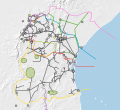
| + | File:DATE-Pacific Map 202101.png|DATE-Pacific Region | ||
File:Map-DATE Pacific North Torbia 202101.png|North Torbia Physical Map | File:Map-DATE Pacific North Torbia 202101.png|North Torbia Physical Map | ||
File:Map-DATE Pacific South Torbia 202101.png|South Torbia Physical Map | File:Map-DATE Pacific South Torbia 202101.png|South Torbia Physical Map | ||
Latest revision as of 16:37, 13 January 2021
The DATE countries listed below are fictionalized territories at the national and first-order administrative levels (i.e. province or county depending on the country). Lower order boundaries such as city wards and municipalities, and physical features such as mountains, rivers, and deserts, have retained their actual names. In many cases literature and media sources will use more than one name for a feature, and may spell them in different ways. As a guide, DATE will follow the National Geospatial Intelligence Agency's conventions contained in the Geonet Names Server (GNS), "the official repository of standard spellings of all foreign geographic names sanctioned by the United States Board on Geographic Names (US BGN)".[1] However, the reader should be cautioned that reference texts and maps may use these other variants. These common variants are also listed in the GNS.
DATE Pacific
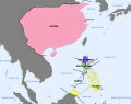
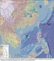
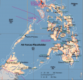
DATE-Pacific Region

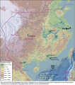
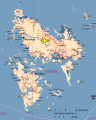
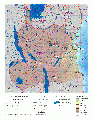
North Torbia Physical Map

South Torbia Physical Map
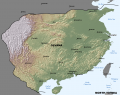
Olvana Physical Map
Belesia Physical Map
Gabal Physical Map
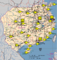
DATE Pacific terrain map
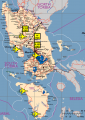
Belesian Luzon terrain map

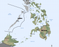
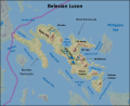
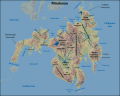
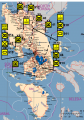
Major Islands and Bodies of Water in Belesia map
Belesian Luzon terrain map
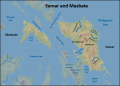
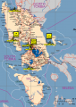
Samar and Masbate Islands, Belesia, terrain map

Panay, Negros, Cebu, Bohol, and Leyte Islands, Belesia, terrain map
Mindanao Island, Belesia, terrain map
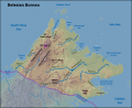
Belesian Borneo terrain map
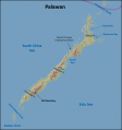
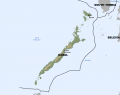
Palawan Island, Belesia, terrain map
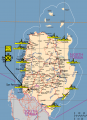
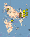
ROT Ground Forces disposition map
ROT Ground Forces disposition map
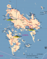
ROT Air Forces disposition map
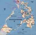
ROT Naval Forces disposition map
PRO Air Forces disposition map
PRO Naval Forces disposition map
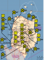
DPRT Ground Forces disposition map
DPRT Air Forces disposition map
DPRT Naval Forces disposition map
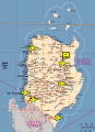
ROG Ground Forces disposition map
ROG Air Forces disposition map
ROG Naval Forces disposition map
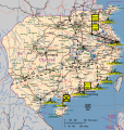
BSA Ground Forces disposition map
BSA Air Forces disposition map

BSA Naval Forces disposition map


DATE Africa
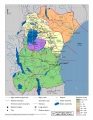
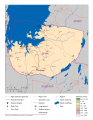
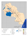
- DATE Africa Physical
- DATE Africa Political
- DATE Africa Regional Overview
- Amari Physical
- Kujenga Physical
- Nyumba Physical
- Ziwa Physical
- DATE Africa Regional Infrastructure
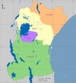
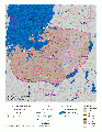
DATE Africa Political Map
DATE Africa
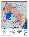
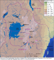
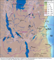
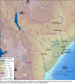
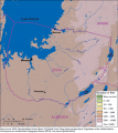
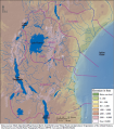
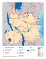
Physical Map of Amari
Physical Map of Kujenga
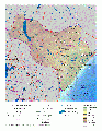
Physical Map of Nyumba
Physical Map of Ziwa
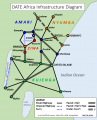
Regional Infrastructure Diagram
Amari terrain map
Kujenga terrain map
Nyumba terrain map
Ziwa terrain map
DATE Africa terrain map

DATE Africa terrain regions map
Ziwa Infrastructure
Kujenga Infrastructure
Amari Infrastructure
DATE Africa Regional Infrastructure
Amari Average High Temperatures (C)
Amari Wet Season Avg. Monthly Rainfall (mm)
Amari Average Monthly Rainfall (mm)


DATE Europe
- DATE Europe Political Boundaries
.png)
_v3-.png)


DATE Caucasus
- DATE Caucasus, Ariana
DATE Caspian Political Boundaries .jpg

- ↑ National Geospatial Intelligence Agency, Geonet Names Server, http://geonames.nga.mil/gns/html/