
DATE Map References
This page is a pilot for map reference presentation. Derivative maps could also be posted or linkeFiles are .jpg format with additional formats noted as applicable.d.
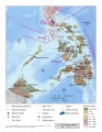
DATE Pacific
Clicking the links takes you to the country page
- Regional Overview (.jpg) (.pdf) (.kml)
- Belesia(.jpg)
- Gabal (.jpg) (.pdf) (.kml)
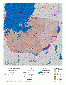
- Olvana (.jpg)
- North Torbia(.jpg)
- South Torbia (.jpg)

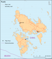
DATE Pacific Theater
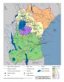
Physical Map of Belesia
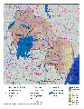
Physical Map of Gabal
Gabal Borders KML (APAN)
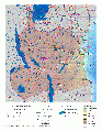
Physical Map of Olvana

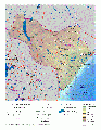
Physical Map of North Torbia

Physical Map of South Torbia


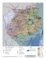
DATE Africa
Clicking the links takes you to the country page
- DATE Africa Physical (.jpg) (.pdf)
- DATE Africa Political (.jpg) (.kml)
- DATE Africa Regional Overview (.jpg) (.pdf)
- Amari Physical (.jpg) (.pdf)
- Kujenga Physical (.jpg) (.pdf)
- Nyumba Physical (.jpg) (.pdf)
- Ziwa Physical (.jpg) (.pdf)
- DATE Africa Regional Infrastructure (.png)
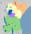
DATE Africa Political Map
DATE Africa Layered PDF
Physical Map of Amari
Physical Map of Kujenga
Physical Map of Nyumba
Physical Map of Ziwa
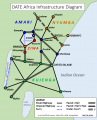
Regional Infrastructure Diagram


DATE Europe
Clicking the links takes you to the country page
- DATE Europe Political Boundaries (.jpg) (.kml)
</gallery>
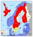
DATE Europe Political Boundaries .jpg
DATE Europe Layered PDF

DATE Caucasus
Clicking the links takes you to the country page
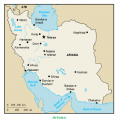
- DATE Caucasus, Ariana (.jpg)
DATE Caspian Political Boundaries .jpg
