
DATE Map References
The DATE countries listed below are fictionalized territories at the national and first-order administrative levels (i.e. province or county depending on the country). Lower order boundaries to include municipalities, and physical features such as mountains, rivers, and deserts, have retained their actual names. In many cases there will be more than one actual name for a feature. For names and spelling, DATE will follow the National Geospatial Intelligence Agency's guidance contained in the GeoNet Names Server (GNS), "the official repository of standard spellings of all foreign geographic names sanctioned by the United States Board on Geographic Names (US BGN)".[1]
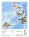
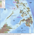
DATE Pacific

DATE Pacific Theater
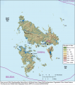
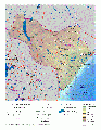
Physical Map of Belesia
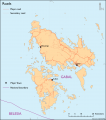
Physical Map of Gabal
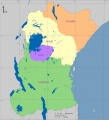
Gabal Borders
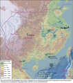
Physical Map of Olvana

Physical Map of North Torbia

Physical Map of South Torbia
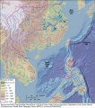
DATE Pacific terrain map
Gabal terrain map
Belesia terrain map

North Torbia terrain map

South Torbia terrain map
Olvana terrain map


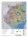
DATE Africa
- DATE Africa Physical
- DATE Africa Political
- DATE Africa Regional Overview
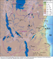
- Amari Physical
- Kujenga Physical
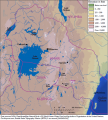
- Nyumba Physical
- Ziwa Physical
- DATE Africa Regional Infrastructure
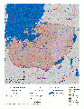
DATE Africa Political Map
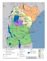
DATE Africa
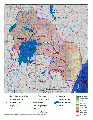
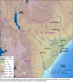
Physical Map of Amari
Physical Map of Kujenga
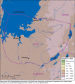
Physical Map of Nyumba
Physical Map of Ziwa
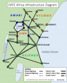
Regional Infrastructure Diagram
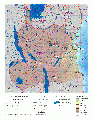
Amari terrain map
Kujenga terrain map
Nyumba terrain map
Ziwa terrain map
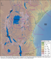
DATE Africa terrain map

DATE Africa terrain regions map


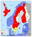
DATE Europe
- DATE Europe Political Boundaries
DATE Europe Political Boundaries .jpg
DATE Europe

DATE Caucasus
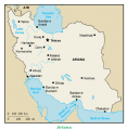
- DATE Caucasus, Ariana
DATE Caspian Political Boundaries .jpg

- ↑ National Geospatial Intelligence Agency, Geonet Names Server, http://geonames.nga.mil/gns/html/