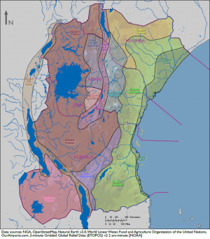
Difference between revisions of "Physical Environment: Ziwa"
(Stripped out placeholder language) (Tag: Visual edit) |
(Partially filled in PE stats table) (Tag: Visual edit) |
||
| Line 6: | Line 6: | ||
== Table of Physical Environment Data == | == Table of Physical Environment Data == | ||
{| class="wikitable" | {| class="wikitable" | ||
| − | + | |'''Measure''' | |
| − | + | |'''Data''' | |
| − | + | |'''Remarks''' | |
| − | |||
|- | |- | ||
| + | |'''Total Area (sq miles)''' | ||
| + | |43,116 | ||
| + | |Includes inland water | ||
| + | |- | ||
| + | |'''Land Area (sq miles)''' | ||
| + | |34,216 | ||
| + | |Excludes inland water | ||
| + | |- | ||
| + | |'''Inland Water (sq miles)''' | ||
| + | |8,900 | ||
| + | |Includes Lake Victoria | ||
| + | |- | ||
| + | |'''Inland Border (miles)''' | ||
| + | |924 | ||
| + | |Amari (437), Kujunga (437) | ||
| + | |- | ||
| + | |'''Coastline (miles)''' | ||
| + | |884 | ||
| + | |Lake Victoria (884) | ||
| + | |- | ||
| + | |'''Highest Elevation (ft)''' | ||
| + | |10,613 | ||
| + | |Jaeger Summit | ||
| + | |- | ||
| + | |'''Lowest Elevation (ft)''' | ||
| + | |1,913 | ||
| + | |Lake Natron | ||
| + | |- | ||
| + | |'''Arable (cultivated) Land (%)''' | ||
| | | | ||
| | | | ||
| + | |- | ||
| + | |'''Permanent Crops (%)''' | ||
| | | | ||
| | | | ||
|- | |- | ||
| + | |'''Permanent Pasture (%)''' | ||
| | | | ||
| | | | ||
| + | |- | ||
| + | |'''Irrigated Land (%)''' | ||
| | | | ||
| | | | ||
|- | |- | ||
| + | |'''Forested Land (%)''' | ||
| | | | ||
| | | | ||
| + | |- | ||
| + | |'''Urban Area (%)''' | ||
| | | | ||
| | | | ||
Revision as of 15:54, 27 April 2018
DATE Africa > Ziwa > Physical Environment: Ziwa ←You are here
To be published
Contents
Table of Physical Environment Data
| Measure | Data | Remarks |
| Total Area (sq miles) | 43,116 | Includes inland water |
| Land Area (sq miles) | 34,216 | Excludes inland water |
| Inland Water (sq miles) | 8,900 | Includes Lake Victoria |
| Inland Border (miles) | 924 | Amari (437), Kujunga (437) |
| Coastline (miles) | 884 | Lake Victoria (884) |
| Highest Elevation (ft) | 10,613 | Jaeger Summit |
| Lowest Elevation (ft) | 1,913 | Lake Natron |
| Arable (cultivated) Land (%) | ||
| Permanent Crops (%) | ||
| Permanent Pasture (%) | ||
| Irrigated Land (%) | ||
| Forested Land (%) | ||
| Urban Area (%) |
Terrain
To be published
Border Disputes
To be published
Bodies of Water
To be published
Mobility Classification
To be published
Natural Hazards
To be published
Subterranean Environment
To be published
Vegetation
To be published
Agriculture
To be published
Livestock and Wildlife
To be published
Climate and Weather
To be published
Seasons
To be published
Precipitation
To be published
Temperature-Heat Index
To be published
Temperature-Wind Chill Index
To be published
Relative Humidity
To be published
Wind
To be published
Summary
To be published
| DATE Africa Quick Links . | |
|---|---|
| Amari | Political • Military • Economic • Social • Information • Infrastructure • Physical Environment • Time |
| Kujenga | Political • Military • Economic • Social • Information • Infrastructure • Physical Environment • Time |
| Nyumba | Political • Military • Economic • Social • Information • Infrastructure • Physical Environment • Time |
| Ziwa | Political • Military • Economic • Social • Information • Infrastructure • Physical Environment • Time |
| Other | Non-State Threat Actors and Conditions • Criminal Activity • DATE Map References • Using The DATE |


