
Nyumba Infrastructure
">DATE Africa > Nyumba > Nyumba Infrastructure ←You are here

Nyumba has the least developed infrastructure in the region. It is only partially connected to regional infrastructure networks. The exception is the northern portion of a transcontinental road corridor that connects southern Africa with the Red Sea. It depends entirely on imported electricity and refined petroleum. Despite its poverty and lack of development, in most years Nyumbans have access to sustainable water resources.
Contents
Major Cities and Urban Zones
| City | Est. Pop.
(2017) |
Pop. Dens.
per km2 |
UBD | Rd | Air | Rail | Sea | Pwr | Wtr | Sew |
|---|---|---|---|---|---|---|---|---|---|---|
| Kismaayo | 235,000 | 5,595 | H- | P | Mo | NE | Mo- | Dg | Dg | Dg |
| Garissa | 119,696 | 1,361 | M+ | Mo | Mo | NE | NE | Dv- | Dv- | Dv |
| Lodwar | 55,006 | 3,039 | L+ | Mo- | Mo | NE | NE | NE | Dv- | Dv |
| Isiolo | 40,153 | 1,940 | M+ | Mo | Mo | NE | NE | Dv- | Dv- | Dv |
| Lamu | 21,736 | 3,105 | M | P | Mo+ | NE | P+ | Dv- | Dv- | Dv |
| Sub-variable Legend (per TC-7-101): UBD - urbanized building density, L - low, M - medium, H - high,
P - primitive, Mo - moderate, C - complex, NE - non-existent, Dg - degraded, Dv - developed |
Sub-variable Legend (per TC-7-101): UBD - urbanized building density, L - low, M - medium, H - high,
P - primitive, Mo - moderate, C - complex, NE - non-existent, Dg - degraded, Dv - developed
Nyumba is the least populated and least densely populated country in the region. The limited infrastructure is significantly degraded. Most of the population and development is concentrated along the Tana and Juba Rivers, and the Indian Ocean ports of Lamu and Kismaayo. Paved roads are limited to the main artery running from Moyale in the north to Isiolo on the Amari border, and a 150 km strip from Kismaayo running northeast to Jilib.
Mwanza (population 811,782 - density 3,313/km2)
Ziwa’s capital city, Mwanza, is located on the southern shore of Lake Victoria. It is divided into two municipal councils: Ilemela in the north and Nyamagana in the south. It sits on the northeast side of a narrow bay on the southern shore of Lake Victoria. While the overall population density is just over 3,000 per km2, some city wards, such as Igogo and Pamba, are more than double that figure. Mwanza is known for its hilly terrain and rock formations. The city center has a high urban building density of modest mid-rise buildings, though this density dissipates quickly outside a 4 km radius from the center. Outer wards are lightly developed but densely populated.
Residential Features. Mwanza’s terrain dictates varied development geometries. Organized settlements tend to follow terrain contours, rather than a directional grid. Wealthier districts feature two story single-family dwellings surrounded by security fences or walls on expansive properties, and central districts contain some mid-rise apartment units. The majority of the population, however, lives in clusters of single story, densely packed huts, with concrete or dirt floors, mud walls and corrugated metal roofing. Improved utilities directly correlate to income level.
Similar to other East African cities, over half of Mwanza’s population lives in informal settlements with limited access to clean water or improved sanitation. Wealthier districts and larger houses are along the shoreline on the southern side of the city, most notably on Capri Point, an isthmus in the Nyamagana ward.
Commercial Features.
Besides housing the seat of government, Mwanza has a relatively large logistics industry supporting lake cargo shipping. It also boasts a large fishing fleet and nascent banking hub, the latter mostly due to its proximity to Ziwa’s diamond and gold fields. Mwanza has a major airport in Ilemela and a large port in the city center with rail access to Kampala, Kujenga. It is also connected to the paved Lake Victoria Ring road.
The major transshipment industry with railheads, wharves and warehouses is located just west of the central business district. A secondary industrial waterfront area occupies a small bay two km southwest of Mwanza airport. This area supports a large commercial fishing fleet and an expansive water treatment facility. . . . .
Two commercial strips radiate from the central waterfront industrial area. The rail strip runs south along the coastline and connects Mwanza with the Kujengan rail system in Tabora via Shinyanga. An easterly strip follows the main east-west corridor (T4) which is also the Lake Victoria Ring Road. Western access on this road is via the Kamanga Ferry which crosses the 4 km span of the bay.
Ukerewe Island (population 396,607 - density 642/km2)
Over three times the size of Staten Island, Ukerewe Island is 50 km north of Mwanza. A three-kilometer channel separates Ukerewe from the mainland. Ukerewe has the least developed infrastructure of any urban center in Ziwa. Besides the city of Nansio on the southeast side of the island, and adjacent Kisoria on the other side of the channel, Ukerewe has a widely distributed population of mostly subsistence farmers and fishermen. Since no bridge connects Nansio (pop. 7,600) with Kisorya (pop. 10,100), all access to the island is either by ferry, or general aviation via the 3,000 foot grass airstrip in Nansio. The island has extremely limited municipal and commercial services. Besides the ferry terminal and port facility in Nansio, most of Ukerewe’s 170+ km of coastline is undeveloped. There is one small boat landing site on the north side of the island, and two on the west. .
Shinyanga (population 178,235 - density 2,072/km2)
Shinyanga is 45 km north of Ziwa’s border with Kujenga in south-central Ziwa. It is a strategic junction city halfway between Mwanza and the Kugengan city of Tabora. The northern rail spur of Kujenga’s DARGOMA rail line, as well as the main highway connecting Mwanza with Dodoma, Kujenga, pass through Shinyanga. Shinyanga is also 25 km southwest of Ziwa’s largest diamond mine, a 30 sq km open pit complex.
Most of the city’s construction is close orderly block on the west side (right bank) of the Nkumba River. Residential tracts are relatively large for the region; settlements are arranged formally. Shinyanga sits at the confluence of the river and three other seasonal riverbeds; the city’s grid conforms to these contours. Dense construction is random and confined to the terrain near these riverbanks. The main roads are paved. The city center is a 15x6 city block tract on the north side of the main highway. It is minimally developed and low-rise, but contains most commercial and government services associated with a regional capital.
The railway station and freight yard sits directly across the highway from the city center. A major bus terminal with coach service to major east African cities is in the core periphery just north of the city center. A disused airport with a 6,700 ft. unpaved runway is 10 km to the northwest of the city center.
The main industrial activity is collateral support for the nearby diamond mine and the many farms situated along the riverbanks.
Musoma (population 154,355 - density 1,286 /km2)
Musoma sits on a peninsula stretching into Lake Victoria on the south side of Mara Bay. The bay forms Ziwa’s northern border with Amari. Musoma’s main road artery is a 16 km spur connecting to the Lake Victoria ring road. It is 27 km from the Amari border by road, and 4km by ferry to the small town of Kinesi, Amari. Secondary minibus routes connect Musoma to regional cities. A 5,000 foot improved unpaved airfield provides limited scheduled air service through Mwanza.
While the greater Musoma city limits comprise approximately 50 sq km, the city center is located on a three sq km triangular spit on the north side of the larger peninsula. The airport the city, with the commercial and administrative district to the east, and close block orderly low-rise residences to the west. While Musoma has some small sections of dense unplanned neighborhoods, the majority of the residential neighborhoods have relatively large lots that conform to a general grid.
In addition to basic municipal services and modest light industry, Musoma has many hotels, restaurants, banks, and filling stations. Similar to other cities on Lake Victoria, Musoma’s economy depends mainly on commercial and subsistence fishing. Because of its location, accessibility, and infrastructure, it is a regional recreation destination.
Geita (population 99,795 - density 491/km2)
Geita is the most significant settlement in central Ziwa. It is minimally developed, with few multi story buildings within a small business district. East Africa’s largest gold mine is one kilometer west of the Geita city limits, and is the region’s major economic engine. Geita Airport is adjacent to the mine. The city center has a bus station with coach service to major East African cities.
Geita, and the smaller community of Nyanumbu directly south, measure about 20 sq km, with most development concentrated on either side of the main thoroughfare radiating from Geita’s southwest city center. Construction is a mix of semi-orderly blocks on the north side, and more random patterns to the east. Two large compounds dominate the southeast quadrant of Geita. The largest is a 170-acre complex with lodging, meeting, park, and recreation facilities, while a smaller 80-acre tract is an underdeveloped farmstead with extensive vegetation. Large residences with acreage and security compounds are concentrated in the outer western reaches of the city.
Image Gallery
Downtown Nairobi, Photo: Mwangi Kirubi (CC BY-NC 2.0)
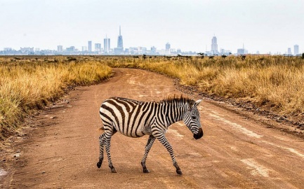
Outskirts of Nairobi, Photo: Mwangi Kirubi (CC BY-NC 2.0)
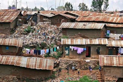
Kibera Slum, Photo: Colin Crowley (CC BY-SA 2.0)
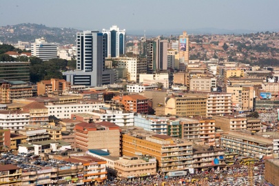
Kampala Skyline, Photo: Lauren Parnell Marino (CC BY-NC 2.0)
Arusha Street, Photo: Roman Boed (CC BY 2.0)
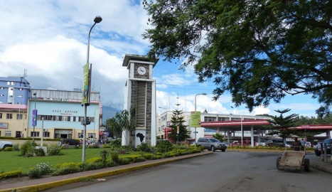
Arusha City Center, Photo: Roman Boed (CC BY 2.0)
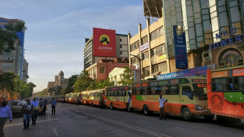
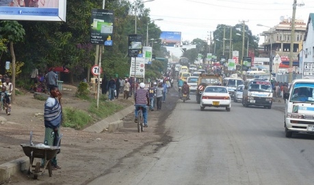
Mombasa Street, Photo: chiefmoamba via Flickr (CC BY-NC-ND 2.0)


Utilities
Electricity Generation and Transmission
Ziwa’s sole power plant, Mwanza Power Station, generates 60 Mw, roughly the equivalent of seven brigade-size base camps. Ziwa imports about 80% of its electricity, almost entirely from Kujenga. The main transmission route runs through Shinyanga. A transfer corridor between Amari and Ziwa around the eastern shore of Lake Victoria is under construction. Once complete, this line will connect Ziwa to Amari’s grid.
Modest wind and solar power projects are under consideration as is a hydroelectric project on the Mara River, Ziwa’s only perennial river.

Water
See also: Physical Environment: Ziwa
The majority of Ziwa’s terrain drains into Lake Victoria, which in turn drains to the Nile River. The rest drains to the small lakes surrounding southern Ziwa. Ziwa is a member of the Nile Watershed Congress, an intergovernmental organization chartered to address access, irrigation, hydroelectric power, and environmental issues related to the Nile. This international agreement restricts upstream irrigation and hydroelectric projects. Downstream members must be approve these projects.
Over 45 percent of the population has access to piped water, mostly from neighborhood standpipes. In the cities, twice as many residents get their water from neighbor’s taps rather than public standpipes. Rural census data is less complete than Amari, however a comprehensive list of borehole/spring locations supports the conclusion that less of Ziwa’s rural population relies on standing water or vendors.
Transport Architecture
Roads
Ziwa’s roads are typical of the region in general. The more densely-populated north has access to the major paved highway that circumnavigates Lake Victoria. This ring is accessed by a paved feeder highway coming up from Kujenga via Shinyanga in southern Ziwa. A more direct unpaved route from eastern Kujenga passes through the environmentally sensitive Serengeti and Ngorogoro Conservation Area. It is not recommended for commercial traffic. Lastly, a paved highway connects Shinyanga with points west, hugging the southwest border of Ziwa where it turns north to connect with the Lake Victoria ring road along the Kujengan panhandle and continues to Kampala, Amari.
As with Kujenga, there are no bridges or tunnels that will affect normal traffic. Oversized traffic requires route surveys and permission from Ziwa Road Authorities, Police and other relevant authorities.
Rail
Ziwa’s only railway is a 1930’s era north-south spur off of Kujenga’s meter gauge DARGOMA line connecting Tabora in Kujenga with Mwanza; built to support the Lake Victoria rail ferry service. Lack of consistent and seaworthy rail ferries and irregular track maintenance make the rail system less reliable than the road network. Despite that, there are proposals to reinvest in the current railway andas to expand it with a standard gauge line connecting Shinyanga to Arusha, with a northern spur to Musoma. Subsequent plans would continue the line west and north, eventually connecting Kampala.
Aviation
Ziwa’s only international airport is Mwanza International (ICAO code HTMW) with a 10,700 ft. paved runway and basic precision approach instrumentation. It is also the only paved runway in Ziwa. Seronera (Serengeti), Shinyanga, Musoma, and Loliondo have airports with unpaved runways greater than 5,000 ft. Ziwa’s additional 33 unpaved airstrips are to be considered operational only after a thorough on-site survey.
Ziwa does not have a national flag carrier and most international flights have an intermediate stop at a regional African gateway. However, the Ziwan government wants to develop Mwanza International into a strong competitor for direct international service due to its proximity to Serengeti National Park and other regional tourist destinations.
Maritime
Ziwa’s maritime interests are limited to the Lake Victoria ports of Musoma, Mwanza, and to a lesser extent, Nansio on Ukerewe Island. See [Regional Maritime] section for more information.
Pollution
The environmental impact of mine tailings is beginning to get international attention. Toxic runoff includes cyanide, arsenic, and mercury compounds used to extract trace amounts of gold from ore. The settling ponds are often close to the great lake watersheds.
Some international watchdog groups are sounding the alarm regarding water pollution in Lake Victoria. The two main sources are untreated sewage and fertilizer runoff. The combination is increasing the toxicity of the lake water and reducing the oxygen content, which in turn is devastating the fisheries.
Lake Victoria also suffers from a proliferation of non-native invasive species, particularly large Nile Perch. These fish are a significant source of revenue and sustenance for local fishermen, but have decimated native fish stocks and threaten the lake’s water chemistry.
| DATE Africa Quick Links . | |
|---|---|
| Amari | Political • Military • Economic • Social • Information • Infrastructure • Physical Environment • Time |
| Kujenga | Political • Military • Economic • Social • Information • Infrastructure • Physical Environment • Time |
| Nyumba | Political • Military • Economic • Social • Information • Infrastructure • Physical Environment • Time |
| Ziwa | Political • Military • Economic • Social • Information • Infrastructure • Physical Environment • Time |
| Other | Non-State Threat Actors and Conditions • Criminal Activity • DATE Map References • Using The DATE |